A selection of a few adventures and days out around Devon and beyond.
Newton Pop to Tipton St John circular walk.
I love walking the public footpaths of Newton Poppleford, either to Aylesbeare common, along the river to Otterton or towards Harpford and Tipton, there’s so many different routes to take through this lovely little village. I had a lot of interest in the walks I do from Newton Pop to Tipton St John, so I’ve decided to write down this 5 mile circular walk that takes you through public footpaths, woodland, along country lanes and then back along the river.

The River Otter, Tipton St john.
There’s plenty of places to park in Newton Poppleford. I prefer to park in School Lane car park, its a free car park opposite the Primary School, just turn right after the traffic lights (if coming from Exmouth/Exeter) on the main road and the car park is on the right. Alternatively, you can park along back lane (by the recreation ground). From School Lane car park, there’s a public footpath in the corner, by the garages, that leads down past St Luke’s Church on the right. I walk down this path and usually have a look at the red telephone box book library on the left, before turning right down the road, past some lovely thatched cottages.
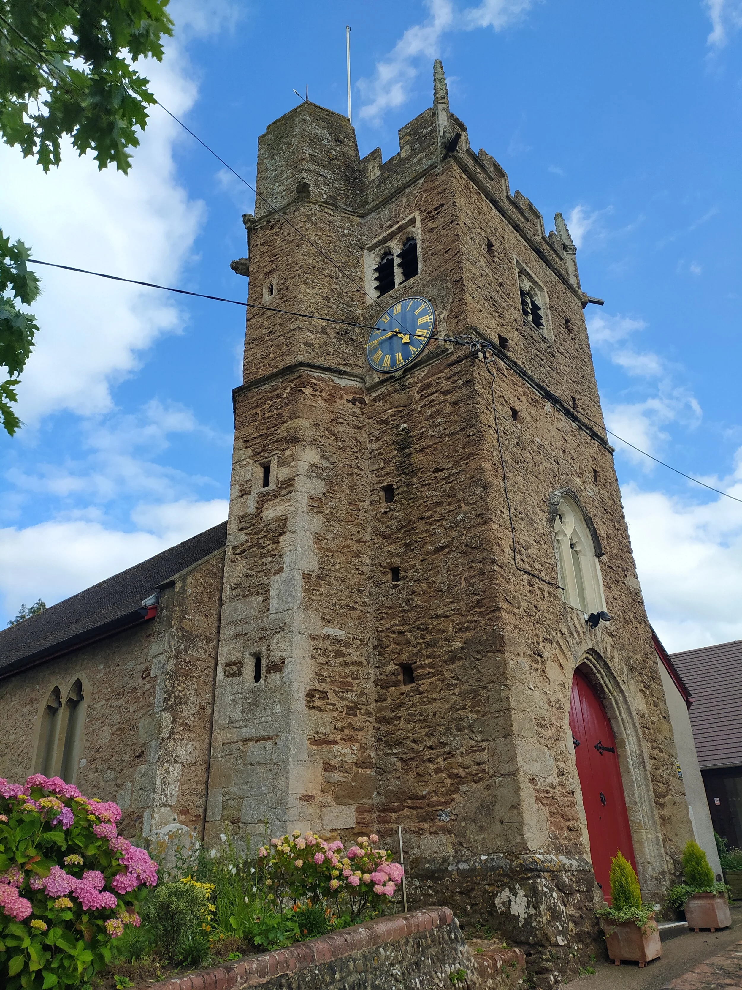
Pass St Luke’s Church on your right.
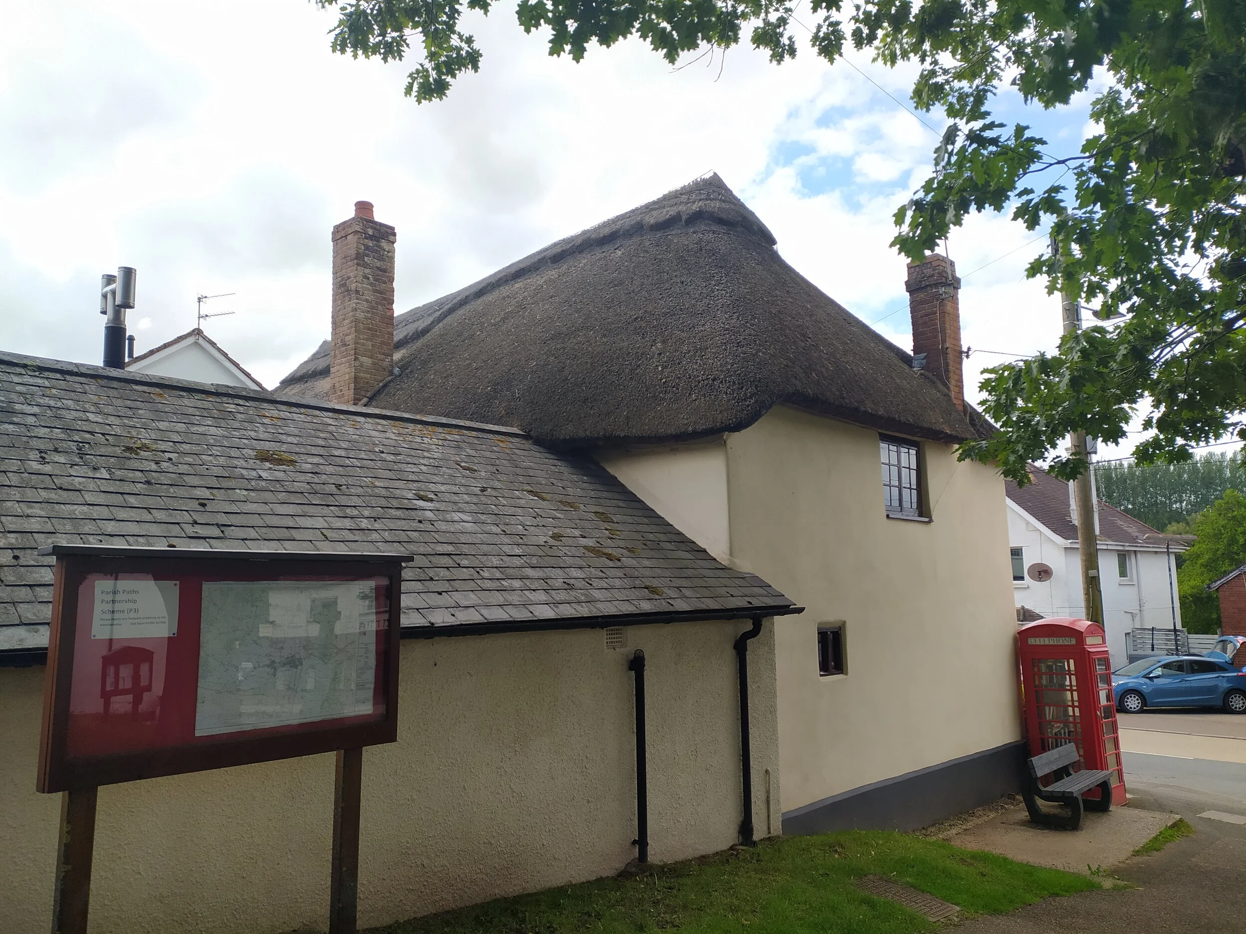
A map of Newton Poppleford and the telephone box book library.
After a short walk down the road, I soon pass a carpet and interiors shop on my right. From here I carefully cross the road and turn left onto Back Lane, walking past tennis courts and a play park on my left. Soon I spot a public footpath leading to fields to my right, I ignore this path (I’ll be coming back that way though) and instead turn left where I soon spot the garden plants for sale outside someone’s house. This is one thing I love about Newton Pop. It has such a community feel to it, you’ll find a lot of houses selling their local produce if you walk around and explore the village. Just before this house with the plants for sale is a gravelled path with the Orchard ahead of me and a metal kissing gate to the right;. I take this path through the kissing gate and into some woodland. From here, I follow the path ahead, being careful not to trip over tree roots underfoot.

The Orchards to the left, the footpath to the right.

The woodland walk, part of the East Devon Way.
Soon I come to a choice of two paths, one going up some steps to my left, and the other going down and over a bridge towards a field to my right. I turn left here and climb the steps, eventually I see some steps to my left, this footpath leads to the Orchard. Although a nice walk; I’m not going this way today, instead I carry on ahead, where eventually I walk up more steps and through a wooden gate leading to a field.

The steps leading to the Orchard.

The footpath leads into a field.
There’s a clear path on the outskirts of the field that I follow all the way down, through a kissing gate and where I can hear, and then see, the stream trickling underneath. This path turns left, where I then notice some interesting old trees, with roots wrapped around one of them. (If you do this walk, you’ll know the one I mean!) I soon leave this path and follow the footpath arrows pointing me up a hill. Once at the top of this hill, I take a quick break to take in the views below. From here I spot Fire Beacon Hill, Mutter’s Moor, Peak Hill and the trees in the Orchard.

The clear path through the fields.
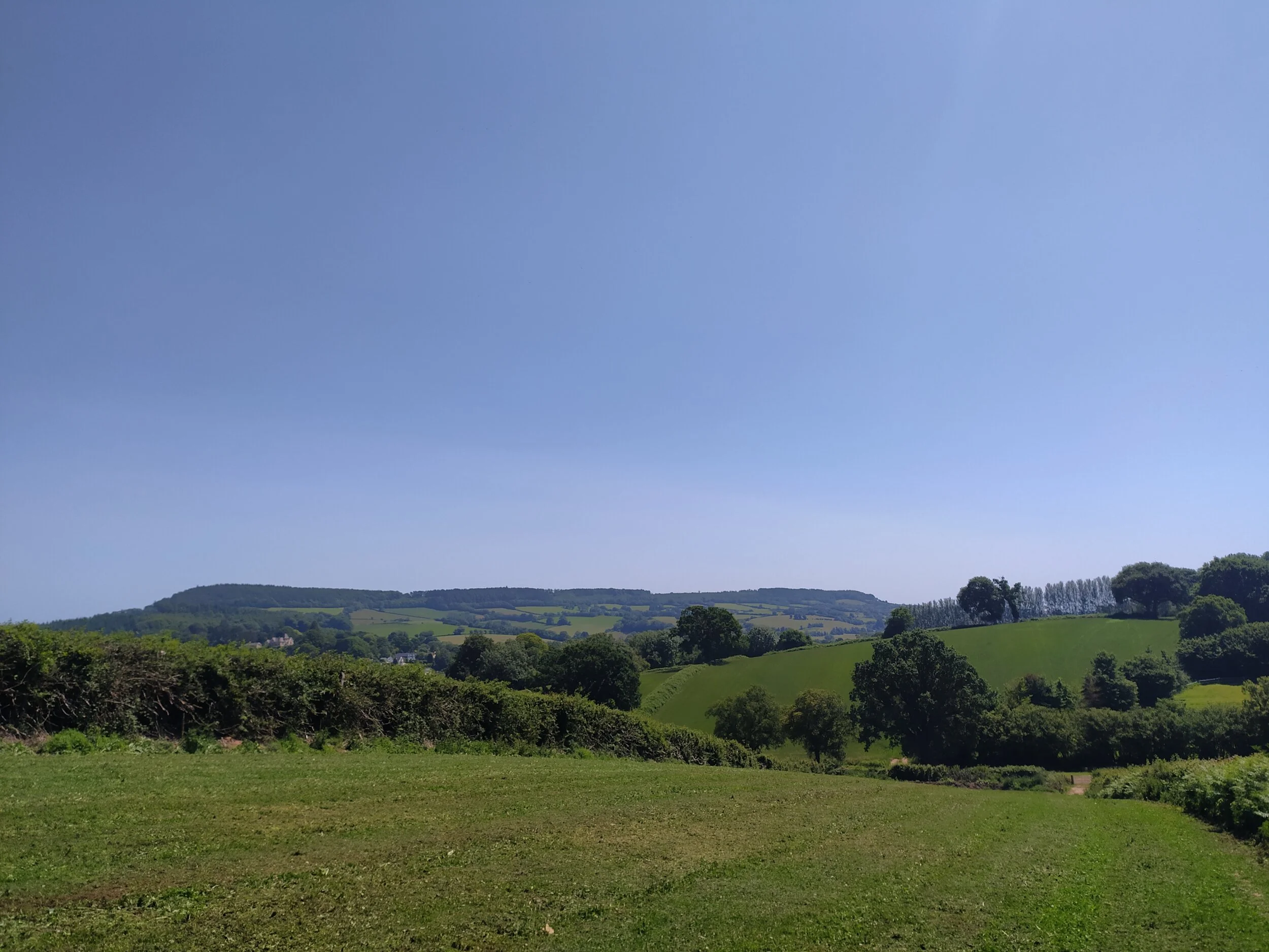
Great views from the top of the hill.
After following the footpath through two more kissing gates, it soon leads onto Lynch Head road. From here I turn right and walk up the road which soon descends into the small village of Venn Ottery. Before I arrive in this village, there’s another great view point at the top of the road, over a farm gate. I stop for a moment and take in the views, spotting Tipton St John to the left, nestled into the Valley.

Tipton St John nestled to the left of the Valley.
Once in Venn Ottery, I follow the road around to the right, where I also see a sign telling me this the way to Tipton St John. I’m soon treated to yet more beautiful views of the East Devon Countryside over a poppy field to my right as I edge closer towards the village. Once I arrive at the top of this road, I walk down the road to my right which leads into Tipton St John by the local Primary School.

Yet more beautiful views, over a poppy field.
Once in Tipton St John, I always admire the beautiful thatched cottage to my left, by the Primary School. The elegant windows really do stand out due to their interesting shape. If you’re doing this walk and want to cut it short, you can turn right at this junction, past the school and find the footpath before the bridge, which will take you back to Newton Poppleford via the river. Today I chose to walk further up the river towards Ottery St Mary. I turn left at the school junction and pass the Church of St John the Evangelist on my left, continuing up the road (Tipton Vale) with a stream to my right, until I spot a public footpath on the right.

Church of St John the Evangelist.
I follow this footpath straight ahead, with fields on either side of me. Soon I cross over a stream via a little footbridge, then pass through a gate where I’m greeted by the River Otter with the old railway bridge (now a footbridge) just ahead of me. From here I carry on walking alongside the river, here is a great spot for dogs and children to play in the river, just by the bridge.

The River Otter.

The Old Railway Bridge over the River Otter.
Once I pass under the old railway bridge, I carry on walking ahead until I meet a footbridge crossing right over the river. I decided not to carry on ahead towards Ottery St Mary today, instead I cross this bridge, passing Tipton Mill on my left, and turn right along a footpath into some fields. Here the river soon turns into a stream on my right as I enter some woodland and cross a couple of stiles, then walk alongside a beautiful garden that has the stream passing through it. From here I soon leave the footpath and enter into Tipton St John again.

Tipton Mill to the left.

Tipton Mill, currently under restoration.
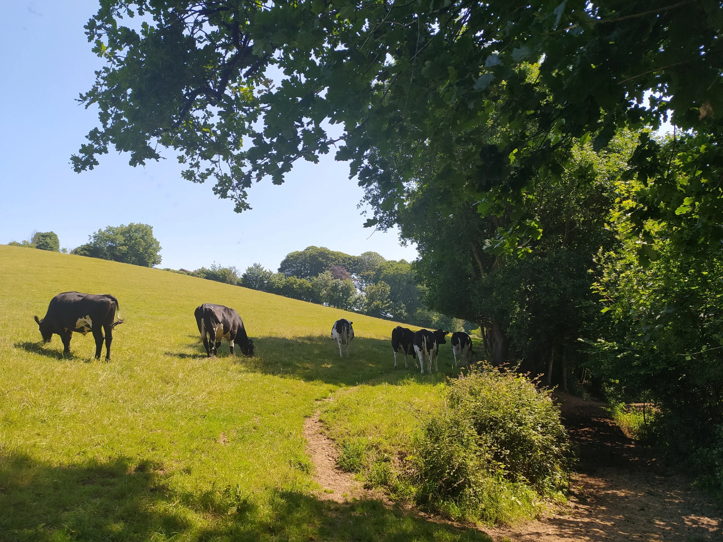
Be aware, if walking with a dog, there may be livestock in these fields.
Tipton is a lovely little village, as I turn right, towards the river, I pass another telephone box library on my left, a community stores on the right and then the local pub, ‘The Golden Lion’ with a beer garden that looks very welcoming in the sunshine. After walking past the pub, I cross over the river via a bridge that is decorated with beautiful flower boxes.

Tipton’s local pub, ‘The Golden Lion’.

The rather welcoming pub beer garden.

Beautiful flowers on the bridge overlooking the River Otter.
From here, I join the riverside walk via a footpath to my left. Again, this stretch of the River Otter has plenty of places for dogs to dip in and out of the water for a paddle. There’s some lovely views of the rolling hills to my right, and plenty of butterflies and dragonflies darting about between the river and the wild flowers. I follow the path along the river, passing through several gates.

There’s plenty of places for dogs and children to paddle in the river.
Eventually, this footpath opens up, normally with cows grazing in a field to the right. From here, I soon spot the familiar sights of Newton Pop ahead, as well as Harpford Parish Church over the river to my left. I ignore the red bridge to my left which leads to Harpford, this is a lovely walk too, which I’ll hopefully document another day. The footpath to my right also leads back to the woodland that I started the walk in, by the gate to the Orchard. I continue on ahead, where I soon leave the fields through a gate onto Back Lane once again. From here, I walk down towards the tennis courts, then turn right onto a footpath, keeping the tennis courts to my right and a stream flowing to my left. I follow this path all the way along, until I reach a road to my left (Meadow Drive). From here, I walk up the road, and soon spot the familiar red telephone box on the other side of the road. Here I carefully cross the road (there is a pedestrian crossing to the left) and follow the path up beside the church, to end the walk back in the School Lane car park.

Harpford Parish Church on the other side of the River Otter.

The walk back towards the car park.
Hopefully this walk is clear enough for those of you who have asked me to document it. It’s an enjoyable walk to do, especially on a warm, sunny day, when you can sit and relax by the river, watching dogs and children playing and cooling down in the water. If you’re feeling more adventurous, you can make this walk even longer by walking further up towards Ottery St Mary. For those of you interested, I’ll post more about that walk another day.
Castle Lane to East Budleigh Footpaths
I love this walk for many reasons, one being that I hardly see anyone on it. From leaving the cycle trail to arriving at East Budleigh I didn’t see a single person on the walk; Perfect right now when social distancing is a priority! It also brings happy memories of walking around Hayes woods and Hayes Lane with a good friend of mine and our dogs. I also just love East Budleigh and all it has to offer in its little chocolate box village! I did end up up walking quite a few miles in the end, but that’s also due to doing a detour to Hayes Barton, but if you like a quiet walk with equal views of countryside and coast then this one is for you.

Views of East Devon villages and coastline from the footpath.
I started this walk at the Castle lane section of the Old Railway line between Exmouth and Budleigh. To get here you just turn right after the recycling centre along Salterton Road, if you’re coming from Exmouth towards Budleigh, or if you’re arriving from the opposite direction, then its the first turning on the left after the main Budleigh roundabout into Exmouth. There’s normally plenty of parking available on the roadside and the entrance to the Old Railway line is obvious to see from the road.

The bridge of the Old Railway Line
Once you spot the entrance to the railway line, you’ll see a map showing you where this trail leads, if you aren’t familiar with it then I definitely recommend walking along here, it’s a popular walk amongst cyclists, walkers and horse riders. It’s also worth looking back at old photos of the railway line and stations that used to be here before Dr Beeching closed them in the 60s. After you’ve had a look at the map, walk down the path infront of you and then turn right, where you’ll spot the bridge you were just on, which I’ll now be walking underneath.

Old Railway line in Spring
This trail is always a peaceful walk, hearing the birds singing above and squirrels scurrying about, the light glistening through the blanket of trees onto the path. I also find it especially beautiful in Autumn, which I’m sure I’ll post about in a few months. When walking this path you can almost forget you’re walking alongside a fairly busy road. I carried on walking this path and soon saw a footpath to my left, this leads to Knowle and East Budleigh common. The local forest school is also situated in this woodland, it’s a lovely area to explore, especially the lane into Knowle with the stream flowing alongside you. I’m not going that way today though, instead I walk straight ahead, up a slope, until I reach the end of the trail.

Views of a thatched cottage.
As I exit the cycle trail, I then turn left up Bear Lane where I soon spot a figure of Winnie the Pooh to my left. Sadly this isn’t where he lives, but it is home to ‘Pooh Cottage’, a holiday park that I find aptly named due to the lane it is situated on. I carry on up this lane which boasts beautiful views of fields and the sea to my right, tall pine trees towering over me and a beautiful thatched cottage to my left, before I reach the end and then turn right down a dusty track.

Trail leading to the woodland.
Once I get to the bottom of this trail, there is a path going off to the left… don’t go this way. Instead, I carried on ahead where I pass a farm gate on my right and then another one round the corner to my left. These fields are home to dairy cows owned by Dalditch Farm. From here, I look back over to my right and catch a glimpse of the rooftops of Budleigh Salterton and the vibrant blue sea in the distance. I make my way up between the foxgloves decorating both sides of the track which takes me towards a path sheltered by woodland. As I carry on straight ahead, I spot a rope swing hanging from one of the trees on my right.

The woodland with rope swing.
I continue on ahead until I reach two public footpath signs to my right, then take the path of the sign pointing to the left and follow it all the way, where it opens out onto Shortwood Common and eventually leads to a stile with a field on the other side. Once over the stile, I keep to the right as I walk along the outside of the field until I reach a metal gate with a public footpath sign directing me straight ahead.

Keep to the right of this field.
I pass through the metal kissing gate ahead and take in the stunning views on offer along this track. From here I can see the beautiful rolling hills of the East Devon Countryside, with the sea on the horizon. Today was a fairly clear day so i was able to see the coast line, Peak Hill and Otterton Village. As I walked further up this path I could also make out East Budleigh village, which was where I was heading.

I can imagine the sun rising and setting would look stunning from this viewpoint, on a day like today I could make out the white cliffs of Beer and Branscombe. See if you can spot Bicton Obelisk from the top of this hill, it stands out to the left of East Budleigh.

Views of East Budleigh and beyond.
I follow this track all the way round where I now have beautiful views to my left of farmland and a glimpse of East Budleigh down the hill. I eventually meet a stile where I then turned left up a country lane which leads to Hayes lane with an electricity substation right infront of me. From here I stopped to greet some friendly cows in a field and spotted a buzzard circling above, I then turned right down Hayes Lane. As I walked down this lane I could just make out All Saint’s church poking through the hedgerows ahead. From here I enter East Budleigh over a stream where I’m greeted with plenty of thatched buildings adding the character to this village. The first one I spot is Vicar’s Mead (photographed below) which is the old Vicarage. It was also a school for boys taught by the local Vicar. Sir Walter Raleigh was one of the boys educated here.

Plenty of thatched buildings adding character to East Budleigh.
I followed Hayes Lane to the end where I spot the Sir Walter Raleigh pub ahead. From here I turned left, up the hill and past the church to sit on a bench next to the statue of Sir Walter Raleigh before I headed home. If you don’t know East Budleigh well, then it is worth exploring this little village; It boasts so much character with its thatched cottages, Budleigh Brook running through it, plenty of flower boxes bursting with colour and the local roots of Sir Walter Raleigh born and raised in Hayes Barton just up the road.

Houses selling eggs and marmalade with All Saint’s church in the background.

The statue of Sir Walter Raleigh

The ‘Sir Walter Raleigh’ Pub
I headed back home the way I came, but first I took a detour 15 minutes up the other end of Hayes Lane (past the electricity substation) to see Hayes Barton. It’s been a few years since I’ve walked this way and had a glimpse of the home where Sir Walter Raleigh and his family lived. It’s worth a walk up if you haven’t been before but bear in mind it will add time onto this walk (I ended up walking about 7.5 miles today). From here I then walked back via Hayes woods and rejoined the field with the stile.

Hayes Barton, birthplace of Sir Walter Raleigh.
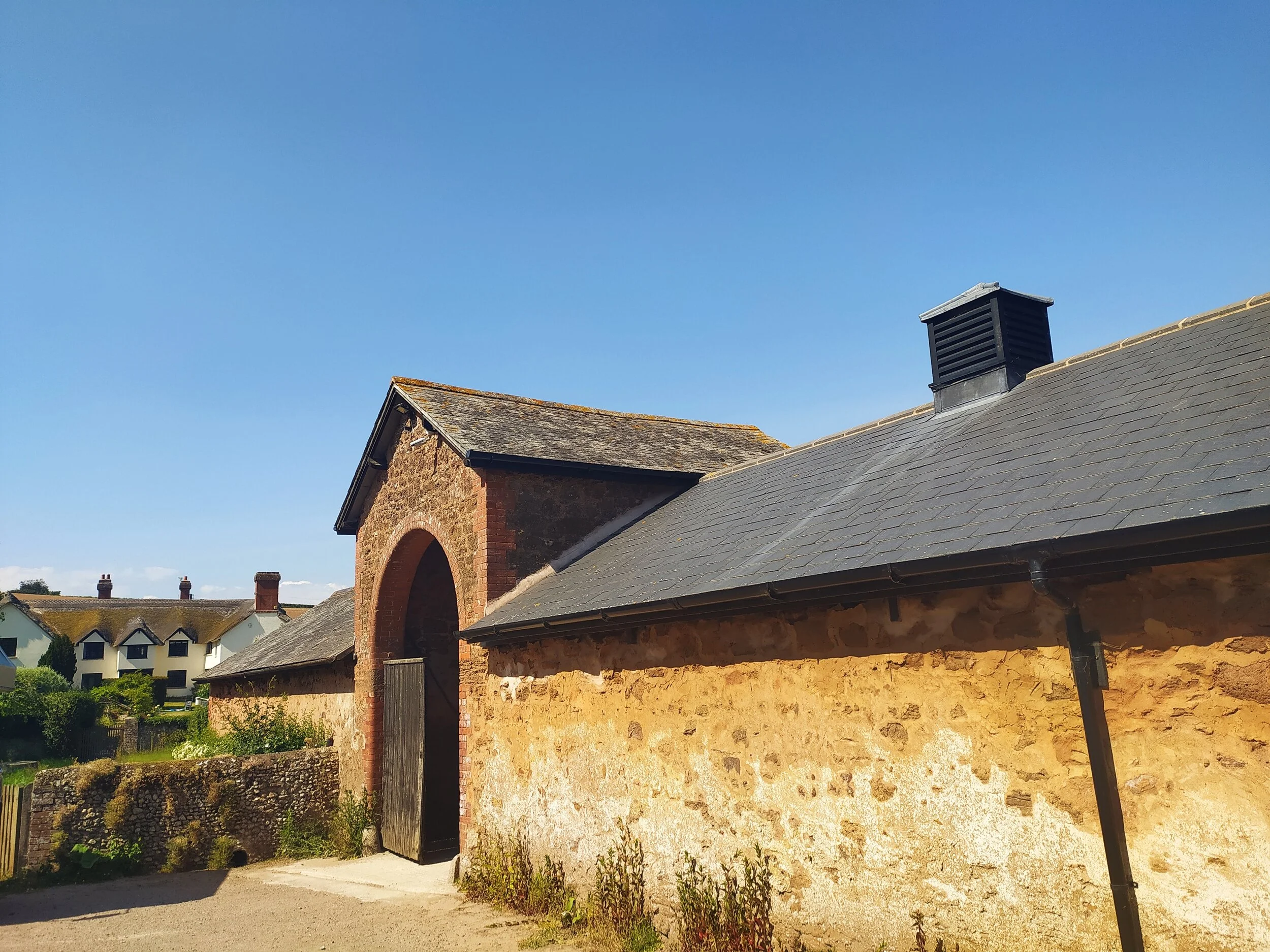
A glimpse of Hayes Barton in the background.
As I headed back to Castle lane the sun was getting lower, which then lights up the trees along the Old Railway line as I walked under the bridge, and back to my parking spot. The Old Railway is a lovely walk in its own right even if you don’t want to walk all the way to East Budleigh.
I took quite a few photos (as usual) of my surroundings on my walk today and also of the beautiful village, so I’ll add more photos to my instagram account which is linked on here if you don’t know it already. (Or you can click here)

Walking back to Castle Lane.