This is a post mainly aimed at those of you who are interested in geocaching, but the walk itself is still enjoyable and the footpaths and quiet country lanes are perfect for walking dogs. We’ve done a few geocaching series in Kentisbeare, and I’ll write up more about the others another time, but this one is focusing on the loop that leads towards Stoford Water and back again to the village, which was just under 3 miles and not too strenuous. I won’t say too much about where the caches were hidden, but there will be photo spoilers in this post!

We started the walk in the (surprisingly large) free car park in the village, which is located behind the church and village hall. (EX15 2AB) From here we walked down a public footpath to the right of St Mary’s Church. The pub here, The Wyndham Arms looked rather inviting as we walked past the beer garden and to the village square in front of it; we were tempted to pop in for a drink, but thought we had better press on with the walk instead.
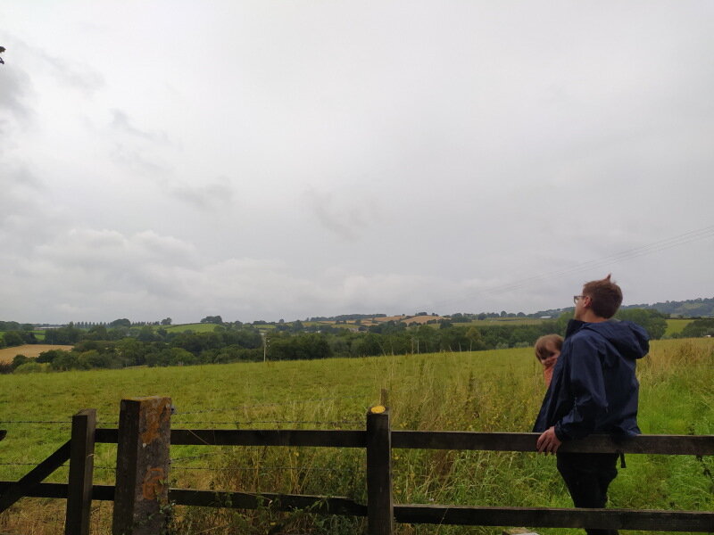
Some countryside views from the footpath.
From here we walked up the road, passing the village stores and telephone box library on our left, then past some cottages before turning left onto a public footpath hidden away next to a national speed limit sign. This footpath took us past a cottage garden on our right, we admired the pretty flowers, vegetable patch and friendly chickens before crossing over a couple of stiles and entering another path next to a field on our left, where our first cache was located. There were beautiful views of the rolling hills from this path, but the footpath itself was a little overgrown with nettles. This wasn’t a problem for Jo, who was wearing trousers, but I thought it would be a good idea to wear shorts (seeing as it is summer!) so I did get stung a few times. Once we finally found the first geocache, (which took us longer than it should have, and we had a large group of cows watching us the whole time!) we crossed over another stile and walked down to the bottom of the field where we soon spotted another stile to cross over for our next cache.
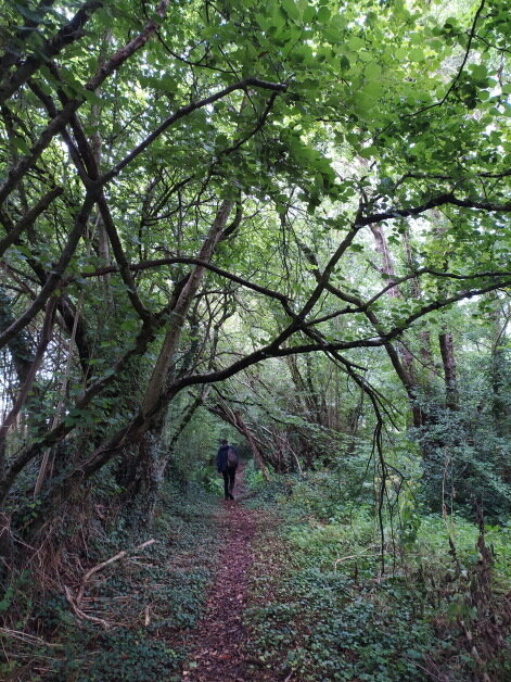
The path through the wooded copse.
Over this stile our next geocache was waiting to be found. We knew it would be somewhere on the small bridge that crosses over the stream that leads to the local fishery lakes. Again, this one took us longer than it should have, considering I’ve found about 600 caches in the past, I couldn’t believe how slow we were at finding these ones today! This one was even in plain sight and in an interesting container; That’s one thing about this walk, children will love all the interesting and funny containers the cache owner has used on this loop. Once we found the cache and signed the log, we continued on ahead, followong a path through the wooded copse which soon led to a quiet country lane. The next cache wasn’t far away, and we found this sneaky one a lot quicker than the first two.
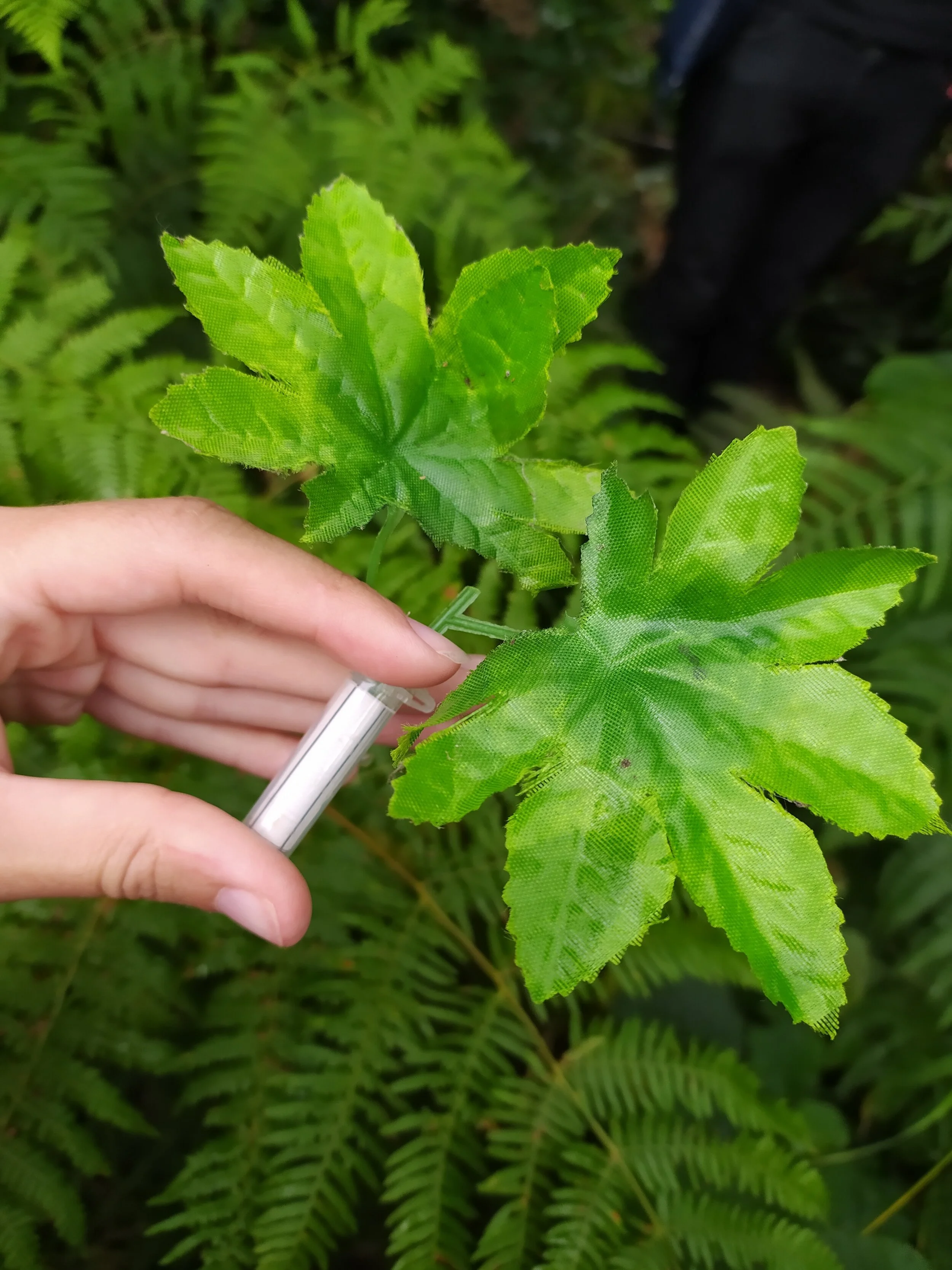
Some of the geocaches found in this series.

After signing the log, we continued up the lane to our next cache opposite an old farmhouse called ‘Lower Moneysland’. This cache was quick and easy to find, by a field full of corn. This was another funny container which I’m sure children will enjoy playing with. Our next cache was a bit further up the lane, in the small hamlet Stoford Water. We passed some pretty cottages and a garden full of roses before arriving at this next geocache. This one was probably the longest one to find as it was fairly small and hidden away very well. There were lots of ‘Did not finds’ logged for this geocache so we were pretty pleased we managed to find it in the end. Nobody likes a DNF when trying to complete a series!

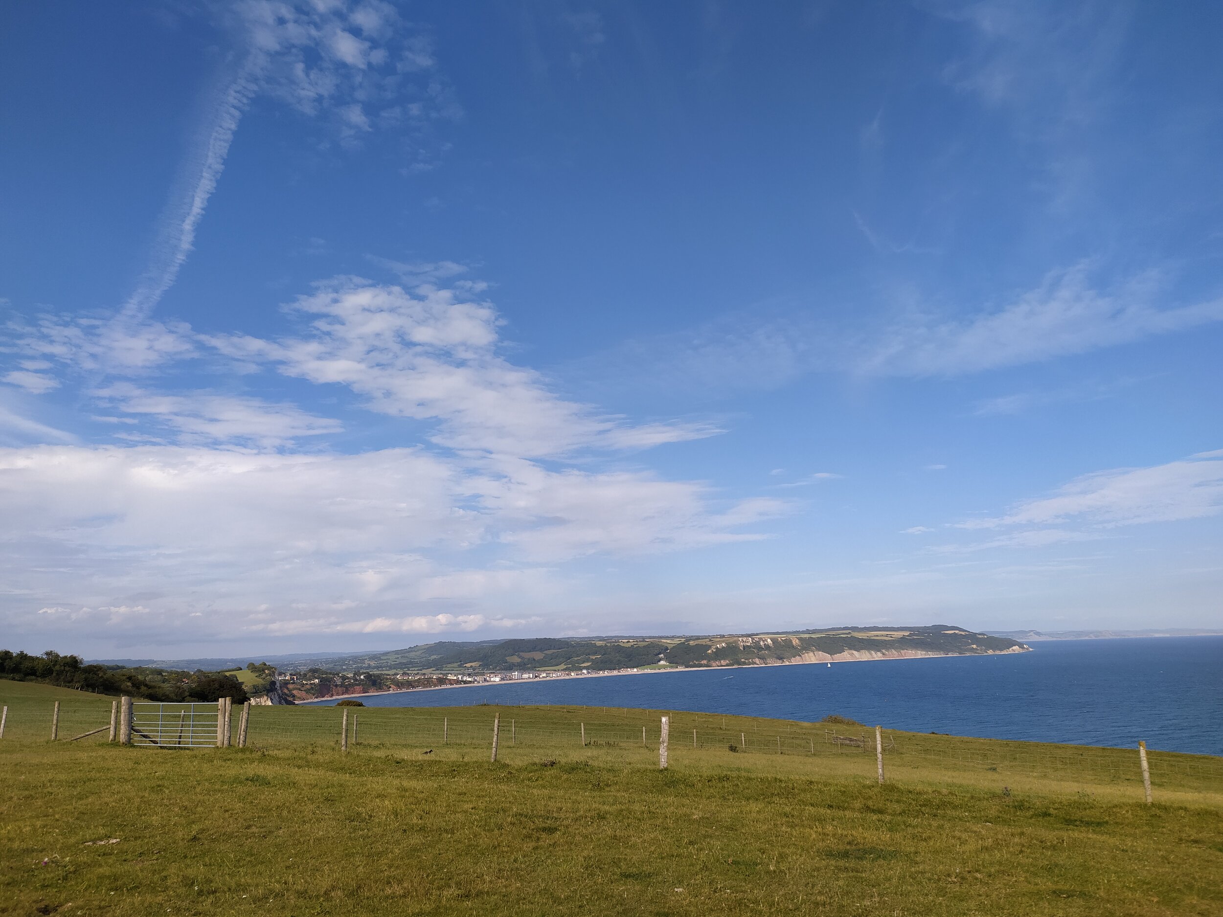
Beautiful views from the top of the footpath.

To get to the next cache, from the crossroads ahead, we took the path to Sainthill with the crossroads sign saying Baptist church pointing in that direction. This took us up another country lane, where we soon found our next cache, the container was definitely one I have never found before, an unusual choice of container but a great idea. After a short walk up this lane, we spotted the footpath on our right which we took to our next cache. This one was a quick find, as I've found ones like this before, and they’re one of my favourite types of container, they blend in well with the surroundings! We continued up this path and once at the top, we found our next cache and were rewarded with beautiful views of rolling hills and Dartmoor in the distance. We stopped to see what places we could recognise from here, before turning right at the end of the path and walking down the lane, where we soon found our next 3 caches, all with quirky and funny containers!

Some of the quirky geocaches on the series

On one of these caches we were pleased to read that it was ‘all down hill from here’ on this walk. The walk itself isn’t at all strenuous but it was a fairly humid day, and I was carrying our 11 month old baby, so walking up the footpath we had just done, was a little bit tiring! We continued to see views of Dartmoor ahead of us on this country lane, as we walked further down until we reached a junction. From here we took the stoney path on the other side of the road to find our next geocache which had 168 favourite points. This one was the reason I wanted to do this series, as I was intrigued as to why it was so popular! It was soon clear as to why it was highly rated. This very large geocache was easy to find, but had a fun game to play in order to find the logbook. We read the instructions then began the game, where we also found a trackable which we decided to retrieve. We were fairly lucky and found the log book quite quickly, but Jo made sure to hide it well in the container for the next cacher!

A very interesting geocache!


We now had just 3 more geocaches to find. The next one was just further on down the path, a lot smaller than the last one, and very hard to find! It was a very clever hide as I was actually looking right at it without realising at first! We carried on down this path which soon passes some farm gates on either side, and then crosses over a stream, where the path turns into a track under tree coverage. As we stopped to find our next cache, I found it rather peaceful here listening to the stream flowing and the birds singing above. The next cache container was yet another clever hide, but we managed to put our hands on this one a lot quicker than the previous one.

The track that leads under tree coverage
We were now just a short walk away from the last geocache of this loop. Once we arrived at the end of this track, we took a while to find this cache even though we had an idea of what it may be, as the hint said it was magnetic. Once Jo reached a bit further over the gate, we found the cache, signed the log and were happy to have completed this series! From here we just had to walk up the road ahead which soon took us back into the village, where we recognised the footpath, village stores and pub that we passed at the start of our walk. We briefly stopped to look at the books in the telephone box library and admire the pretty thatched cottages opposite the pub, before taking the footpath back towards the car park.

Back to the car park next to St Mary’s Church
This walk took us a couple of hours as we were stopping to find all the geocaches and some of them took us longer than others! Children will definitely enjoy the fun and quirky geocaches on this loop, and it’s not too much of a walk for little legs. It was a fairly leisurely walk, with only the slight incline up the footpath to the views of Dartmoor that may be a bit strenuous for some. I would suggest anyone doing this walk to wear suitable footwear and trousers, as the nettles were a little bit overgrown at the beginning of the walk, and some of the paths were a bit uneven and may get muddy after a lot of wet weather. As I said before, we did this walk for the geocaches, but it was still enjoyable and quiet, which is perfect for social distancing at the moment! We didn’t come across many people on this walk, and only a couple of cars passed us on the country lanes, meaning it would be suitable for dog walkers too. If you wanted to have a bite to eat or a drink after your walk, there is the local pub in the village square that I mentioned earlier, but also on the outskirts of Kentisbeare is ‘The Keepers Cottage Inn’ which we drove past on the way into the village. This thatched cottage pub looked rather inviting, with plenty of outdoor space and a pretty little cottage garden out the front. We’ve made a note to visit this pub next time we’re in the area, which I’m sure won’t be long, as we have more geocaches to complete in the village soon.