A Short Walk Geocaching Around Uffculme

This is going to be a quick post about a walk we did geocaching around the woodland and country lanes in Uffculme. For those of you who aren’t aware, Uffculme is a little village in Mid Devon, close to Cullompton. We chose this geocaching route as it seemed to have quite a lot of ‘favourite’ points, and I hadn’t really explored this village much before. Jo has family that live nearby, so we decided we would do it one morning with his dad’s dog, before seeing his family in the afternoon. Just a warning…this post does contain photo spoilers of some of the geocaches we found on this walk!

Gadded Woods.

Gadded Woods.

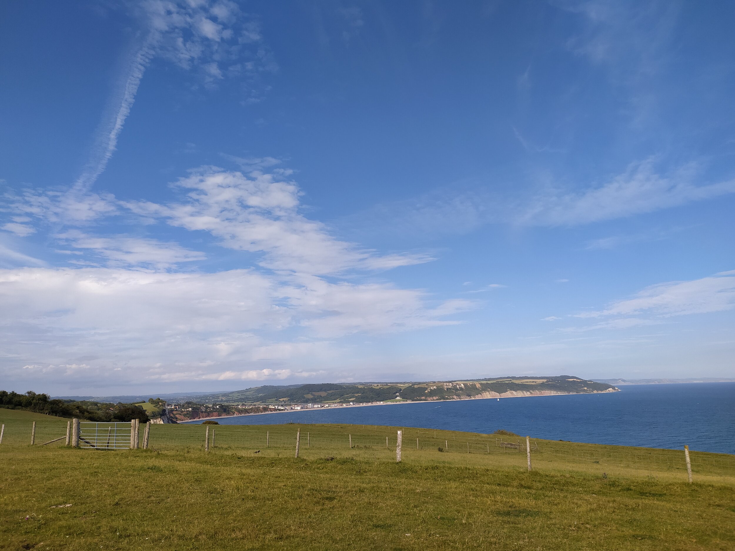
We started this walk by parking in the Magelake Pavillion free Car Park in Uffculme (EX15 3DP), from here we exited back through the entrance and walked up the road to the right, where we soon found our first geocache along the roadside. I’ll try not to give too much away about the caches on this walk, but there will be some photo spoilers! We soon turned right up a road named Cocks Hill, here we walked up the hill, past a house that was selling french beans, and another green house that stood out, not just for its colour, but also the witches broom by the front door! We ignore the turning on the right and continue up the hill. This road, although not very busy, does get narrow for a while so those with children or dogs will need to be careful. It’s not long before we find a public footpath on the right, through a metal gate. This leads us up through some farming fields and then crossing over two stiles. As we walked up this track, I turned back to see beautiful countryside views of the Culm Valley, and Uffculme village below. We could even make out Coldharbour Mill, a woolen mill in Uffculme just to the left.

Countryside views, looking down on Uffculme.

Countryside views, looking down on Uffculme.

Once over the second stile we entered some Gaddon Woods. There are plenty of paths here to explore, but as we were following a geocaching route, we walked straight on ahead, keeping the trees and bank on our right the whole time. As we stopped to find another geocache in the trees here, we looked down once again at the village and rolling hills beyond Uffculme. The weather had been quite unpredictable today, but we could see the rain was about to start again as we saw the rain clouds and mist come in over the village first.

Walking through the woods, with the countryside views to our right.

Walking through the woods, with the countryside views to our right.

Once we found our geocache we continued on ahead through the woods, ignoring a kissing gate to our left, but making a mental note to come back and explore this area another time. The track soon turned into a gravelled path where we saw some cyclists pass us, just as we were about to find another geocache! The trees looked beautiful here, sheltering the path, making me think it must look even more stunning in Autumn, once all the leaves have changed colour.

The muddy track down a hill.

The muddy track down a hill.

Soon we came to a sign post at the end of this path, here we took the track to our right which took us down a hill, still sheltered under trees. I would definitely advise you wear walking boots or wellies for this walk as this stretch of the track had become quite muddy in places due to the rain we’d had in the previous couple of days. As we walked down this track, we continued to see the beautiful views of the countryside through breaks in the trees on the bank on our right as we descended deeper into the woods. This track soon became a bit narrow and more stoney as we followed it round some bends and then out of the woods. Here we found another great geocache, before continuing on past a high brick wall, which we soon find out is someone’s garden, as we walk further on along this path and hear chickens clucking away over a gate. This path soon becomes less stoney and then turns into a country road just after we passed a beautiful big white house called Gaddon House.

Two of the geocaches we found today on our walk.

Two of the geocaches we found today on our walk.

spidercache

As we walk past Gaddon House, we continue on down the hill, on what has now become a country lane, ignoring a signpost pointing towards some houses to the right. We find another geocache in this area, then walk down the lane and pass a red brick house on our right. We soon reach the end of this road, with a tree in the middle of a junction, here we turn right up the road, where we stop at a farm gate to find another cache and look over the fields at the views of Coldharbour Mill chimney in the distance. We both agree we’ll have to come back and visit the mill at some point, as it’s closed at the moment due to the current Coronavirus pandemic.

Views over the fields of Coldharbour Mill in the distance.

Views over the fields of Coldharbour Mill in the distance.

As we continue our walk up the road, we walk past a footpath sign on our left, leading through some fields. We don’t go this way as we are following a geocaching loop, but we will be coming back another day to walk this route as this footpath leads towards the River Culm walk which appeared popular today, as we saw several dog walkers in the distance. It’s not long before we reach our next geocache, then walk up a hill and past some houses on our left. We notice one had a lot of old brick buildings in the front garden which made us think it used to be a farm. We pass another house with horses in some stables and an old vintage car on the driveway. On the other side of this lane we see a vegetable patch and some cows in a field, there’s also a footpath here but we ignore this, which would have taken us back to the path just after Gaddon House. Instead we continue up the hill, past a house that had eggs for sale in their garden, where we meet our last geocache.

Down the road, passing houses and stables.

Down the road, passing houses and stables.

Sadly we didn't find the last cache! We stayed here for a while, determined to find this one as we had managed to find all the others of this circuit, but eventually we decided to give up and both agreed it wasn’t in the place it looked like it should have been. We logged our ‘did not find’ then walked down the road and past a house with some happy chickens digging around in the front garden. On the other side of the road was a yellow house with a garden full of eye catching flowers, here we came to the junction at the beginning of our walk, with the green house now on our left. We then turned left down the hill which brings us onto the road we started on, with the car park just a short walk up the road on the left.

geocache
geocache3

This walk is only around 2.5 miles long and not at all strenuous so it would be perfect for families with young children, especially those who enjoy some fun geocaches. The walk is dog friendly, it does have some country lanes to walk on but they don’t get that busy, and the footpaths through the woods really do make up for it. As I said previously, you can make this walk a bit longer by exploring the woods a bit more, or taking the footpath towards the River Culm. There’s a pub in the village centre called The Ostler Inn, which looked rather inviting from the outside. Bridwell Park, on the outskirts of the village is also temporarily open to visitors to have light refreshments in their Orangery’s pop up cafe, all produce from local suppliers and is also dog friendly. This was something we were tempted to do if we had more time, we’ve made a note to come back and visit it soon when we do a walk along the river.

My favourite geocache of the series.

My favourite geocache of the series.

Beer to Branscombe Coast Path (and back again)

This walk along the East Devon coast path from Beer to Branscombe and back is quite easy to follow as there are very clear signposts and paths leading you in the right direction so I won’t go into too much detail with this walk. We love this stretch of the South West Coast Path because Beer and Branscombe are two of our favourite beaches to visit. Both are small villages, with fishing boats moored on the pebble beaches. I’ve written a post before about Branscombe (here) and I’ll do another post in the near future about Beer as it deserves its own post; it’s such a lovely little Village to stroll round, visiting the independent shops and sitting in one of the deck chairs having an ice cream or chips on the beach, watching the fishing boats go out to sea.

Views of Beer’s white cliffs.

Views of Beer’s white cliffs.

We started this walk by parking in the main car park (Clapp’s Lane) in Beer as we first went down to the beach to have some lunch, but we resisted the urge to get an ice cream, instead promising ourselves we would have one once we reached Branscombe. If you aren’t planning on visiting the village or if there’s no space in the main car park, then there’s a larger one right by the start of the coast path called Cliff Top car park. To reach the coast path from Beer Beach, we walked past our favourite pub in the village, ‘The Anchor Inn’ and walked up Common Lane. From here we had beautiful views of Beer Beach, its white cliffs and the coastline over the well kept gardens, belonging to the beautiful terraced houses on the other side of this road. Once half way up this hill we then turned down a lane on our left called Little Lane. From here it leads us past the bigger car park I mentioned earlier, and a caravan park on our right. Going through a gate, and into a field, this lane joins onto the coast path.

For those of you who enjoy geocaching, there are some great ones along this route all the way to Branscombe. We actually ended up finding some of the ones we couldn’t find last time we walked this route, though it can be hard sometimes as this path can get fairly popular, so you need to have a lot of stealth!

Views of Beer and Seaton from the coast path.

Views of Beer and Seaton from the coast path.

As we carried on along the coast path the views just kept getting better, we did this walk on a hot and sunny day, but a word of warning, be prepared that there’s a steep hill on the way back from Branscombe, which can be made a lot more strenuous in the heat, there’s also a section of rather steep steps if you descend the cliff path, but the rest of the walk is rather easy going and the views make it even more enjoyable. On the way to Branscombe we took the lower path (called Hooken undercliff) when we were given a choice of two options, and on the way back we took the high path along East Cliff.

A lovely spot to sit and take in the views.

A lovely spot to sit and take in the views.

Views of Branscombe beach from the coast path.

Views of Branscombe beach from the coast path.

The lower path takes you through twists and turns with the white cliffs on your right, and there’s a short cut to the Eastern side of the beach when you reach the end of this path. However, there are quite a few steps on this path, whereas if you choose the high path it’s just through several fields then down one set of steps and then down East Cliff hill. One thing to add, at the moment the path will be getting more and more popular as its peak holiday season, the lower path also gets quite narrow in places, meaning it will be difficult to socially distance from others at times.

Some of the steps you’ll encounter along Hooken Undercliff.

Some of the steps you’ll encounter along Hooken Undercliff.

Both paths offer the beautiful views of the coastline and are clearly marked on how to get to the beach. Once we reached the end of the lower path, we could have walked further which would take us out to the bottom of the hill before the car park at Branscombe, instead we chose to enter the beach by a path on our left. This took us to the Eastern end of the beach.

The Eastern end of Branscombe beach.

The Eastern end of Branscombe beach.

This part of the pebble beach is a lot quieter than the main stretch close to the car park. We decided to sit here for a bit and watch a few dogs enjoying the water as the waves crashed against the pebbles. After a while, we decided to walk towards ‘The Sea Shanty beach cafe’ by the car park and the entrance to the beach, it’s a short walk along the beach to get here. This is the only cafe by the beach, but it has a good variety of food and drink options, including a good choice of ice creams which is what we came for!

The Eastern end of Branscombe beach is always a lot more quiet.

The Eastern end of Branscombe beach is always a lot more quiet.

We sat and watched the waves crashing against the pebbles.

We sat and watched the waves crashing against the pebbles.

The busier part of the beach, with The Sea Shanty Beach cafe to the right.

The busier part of the beach, with The Sea Shanty Beach cafe to the right.

After having a great ice cream and relaxing in the sun, we decided we had better start climbing the hill back onto the coast path, to return to Beer. From the Sea Shanty cafe, there’s an entrance to the hill ahead through a gate by the mouth of the river that’s just to the side of the car park. Look for the massive hill, it is hard to miss!

We sat and had an ice cream, while looking at the hill we were about to climb.

We sat and had an ice cream, while looking at the hill we were about to climb.

The hill does have some benches you can rest on if need be, we sat and looked at the views of the beach below before continuing on our walk, up some steps then through more fields which eventually took us back to Beer. Along the way we saw the remains of an old lookout building as we walked past a flock of sheep and down a path that took us through some gates and back to the fields we first started walking in.

The views of Branscombe village, beach and coastline from the top of the hill.

The views of Branscombe village, beach and coastline from the top of the hill.

This walk took us about 3 hours to do, but we did it at a leisurely pace and stopped to do some geocaching. It’s best to give yourself plenty of time, as I’ve said before the hill and steps can be quite strenuous! The stunning coastal views really do make up for the hard work involved on some parts of this coast path though. Both beaches are dog friendly, Beer does have restrictions in place for certain areas (clearly marked) during peak season, but the whole of Branscombe beach is dog friendly all year round. If you are taking a dog on this walk, please bear in mind that there are steep drops from the cliff side so be very careful dogs don’t run off the edge, and as always, keep dogs under strict control around any livestock you may encounter (we walked through fields with sheep and cattle in them).

Views of Seaton from the coast path on the way back to Beer.

Views of Seaton from the coast path on the way back to Beer.