I’ll start off by saying Woodbury Common and the surrounding area is great for exploring. Anyone who hasn’t walked up there before, it’s worth going, especially if you have a dog. The area is full of wildlife but also has a lot of history hidden behind it from World War II, just on today’s walk I spotted several old brick buildings that would have housed the Royal Marines during the war. The Marines still currently use the common for their training and if you’re out walking certain areas you may one day come across them either on land or above in one of their helicopters. This walk I specifically did today involves walking along East Budleigh Common, through to Hayes Wood, Yettington and East Budleigh before coming back through Dalditch and Squabmoor. It’s all dog friendly; there is one road I had to walk along in Yettington, but even so, its wide enough to walk safely, and doesn’t get majorly busy anyway.

East Budleigh Common, the pebblebed heath.
This walk starts in Wheat Hill car park (free), just up from Squabmoor Reservoir. From here I took the main path just to the left of the informatIon sign, which gives more information about the area and the history surrounding it during World War II. From this main path I soon see views of the Sid Valley to my left as well as remains of an old brick building that would have been a ‘Nissen Hut’ housing some of the Royal Marines (Dalditch Camp) in the Second World War. I soon come to a pile of logs on my left, from here I continue on the path ahead (not down the hill), but as I walk past the logs I spot the curved brick wall at the bottom of a hill to my left, this would have been the Marines’ firing range wall, but now it’s hidden away a fair bit by the natural surroundings of trees and gorse. I get a better view of the firing range as I continue on the path and turn right. From here I have a choice of two paths but I continue to follow the clearly marked footpath arrows.

The old Dalditch Camp Firing range wall (This photo was taken at the bottom of the hill but isn’t the path I took on this walk)
I now walk a path where there are trees on my left and more remains of an old brick building on my right, leading through a shaded path under trees. At the bottom of this slope I take the path straight ahead of me, where soon I spot a public footpath sign on my left and a field to my right with a stile. Although the field on the other side of the stile looks rather inviting from this shadowed path, I instead continue ahead, passing some gates on my right. I’m now leaving East Budleigh common behind as I continue to walk along Hayes Wood Lane. This path has so many interesting old trees with roots that stretch far along the bank, it reminded me that the area has quite a few caches, for those geocachers out there!

The inviting field.
I soon meet a Public Footpath sign, pointing left into some woods. I take this path and walk the clear path now directly ahead of me, this is Hayes Woods. It’s important to add, anyone doing this walk will need to stay on this footpath through the woods, as the rest of the area in this wood is private land and out of bounds. This path soon leads down a slope where eventually I spot a white house in the distance. This is Hayes Wood Cottage. It’s not long before I’m walking past this house, on my left, as I then continue on down a track which has views of East Budleigh village and rolling hills ahead of me and High Peak and Peak Hill to my right.

The path leading through Hayes Wood.

Hayes Cottage just ahead.

Country side views ahead.
As I continue walking down this track I soon spot a white house next to a farm, over the hedges to my left. This is Hayes Barton, the birthplace of Sir Walter Raleigh. The house itself is not open to the public, but you’re able to get a closer look of it if you turn left at the bottom of this track, its just a short walk up the road. Today I chose not to take a detour to Hayes Barton, instead I cross the road and enter the public footpath directly infront of me. This path soon leads up a hill, and through some fields of corn. I make sure I stick to the path on the right of the field, and stop for a moment to take in the views of Hayes Barton behind me, Hayes Wood where I had just come from, East Budleigh Village to my right, and Yettington where I’m heading to. I then continue down this path, past yellow footpath signs ensuring I’m on the right track. I soon pass through a wooden kissing gate, turning right towards Yettington. Here I walk a short distance along a road and cross over a bridge, where the stream leads to Sawmill Reservoir. I now turn right, where I see a sign telling me East Budleigh is 1 mile away.

A view of Hayes Barton from the footpath.

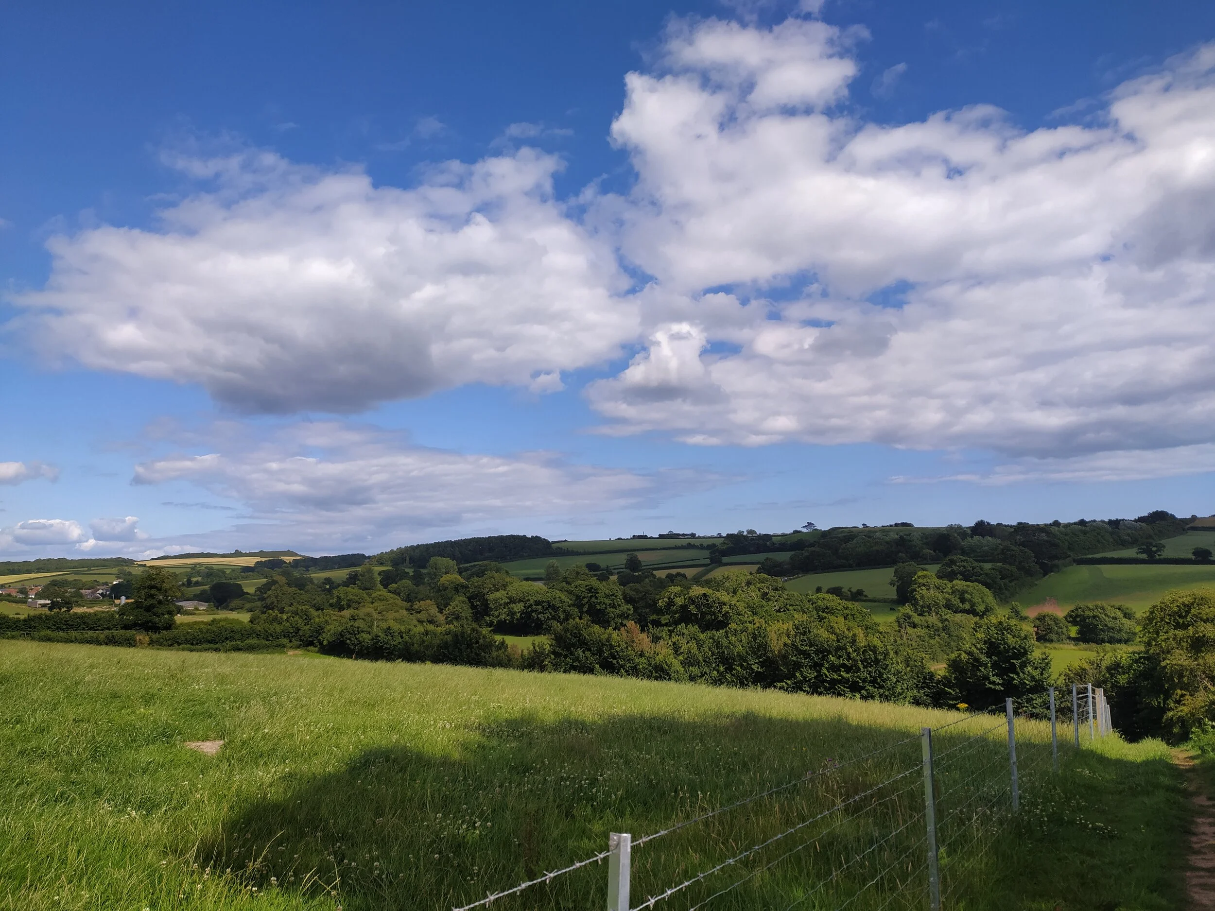
Views of Hayes Wood from the top of the footpath in a field.

The signpost in Yettington.
I follow the sign pointing me towards East Budleigh, which takes me through the village of Yettington. Here I walk past several beautiful cottages, a Brook on my right which children were playing in, and eventually the Village Hall up the road. Once I pass the village hall, I ignore a road on my right, instead I continue straight ahead where I now pass fields on my right with views down to East Budleigh. For anyone doing this walk, this is the road which you’ll have to be cautious of if you’re walking with children or dogs. It doesn’t get too busy, but several cars and a tractor did pass me today, so be aware and keep dogs on short leads and under control.

Views as you enter into Yettington.

Some of the pretty cottages in Yettington.

A beautiful house in Yettington.
It’s not long before I pass Bicton Arena (an equestrian venue) and a turning towards Ladram Bay and Otterton on my left. I ignore this turning and continue up the road where soon I spot the church of East Budleigh in the distance as I walk further towards the village. Soon I come to the East Budleigh sign welcoming me into the village, where I turn round the corner, walking past the church on my right and the Sir Walter Raleigh statue on my left. Here there is some benches to sit on and look down towards the village. I normally take a break here, but it had just started to rain as I entered the village so I decided to press on with the walk.

A nice place to take a break.

Walking down into the village.
It’s worth a little detour to wonder around the village if you’ve not been before. It doesn’t have much to offer in regards to shops, but it does make up for it with character and history. Budleigh brook passes through the village, which leads to the River Otter, there’s a lovely pub called Sir Walter Raleigh, a community stores and a little woodland and recreation ground. As I continue on this walk, I turn right onto Hayes Lane once I passed the local pub on my left. From here I followed the road round to the left, passing several beautiful cottages and a public car park on my right before crossing a footbridge over a stream and Vicar’s Mead (where Sir Walter Raleigh was educated) on my left. I love spotting the little thatched animals that sit upon some of the thatched cottages in the village, including Vicar’s Mead’s courtyard wall.

Sir Walter Raleigh pub.

The thatched animals on the courtyard wall of Vicar’s Mead.
Once I pass Vicar’s Mead I see fields to my right by a Weir (you won’t be able to see the Weir, just hear it), these are the fields I could see previously when walking out of Yettington by Bicton Arena, meaning I’m now at the bottom end of the fields looking up at where I had just been. From here I continue on where soon I see an electrical substation on my right and a track on my left. I take this track up where soon I spot a public footpath sign, I cross the stile here and walk up this hill where I’m rewarded with stunning views of East Devon, including Otterton, East Budleigh, Bicton Obelisk, High Peak and Mutter’s Moor as well as the sea. I eventually leave these views behind when I leave this path through a gate and enter a field immediately in front of me through another gate.

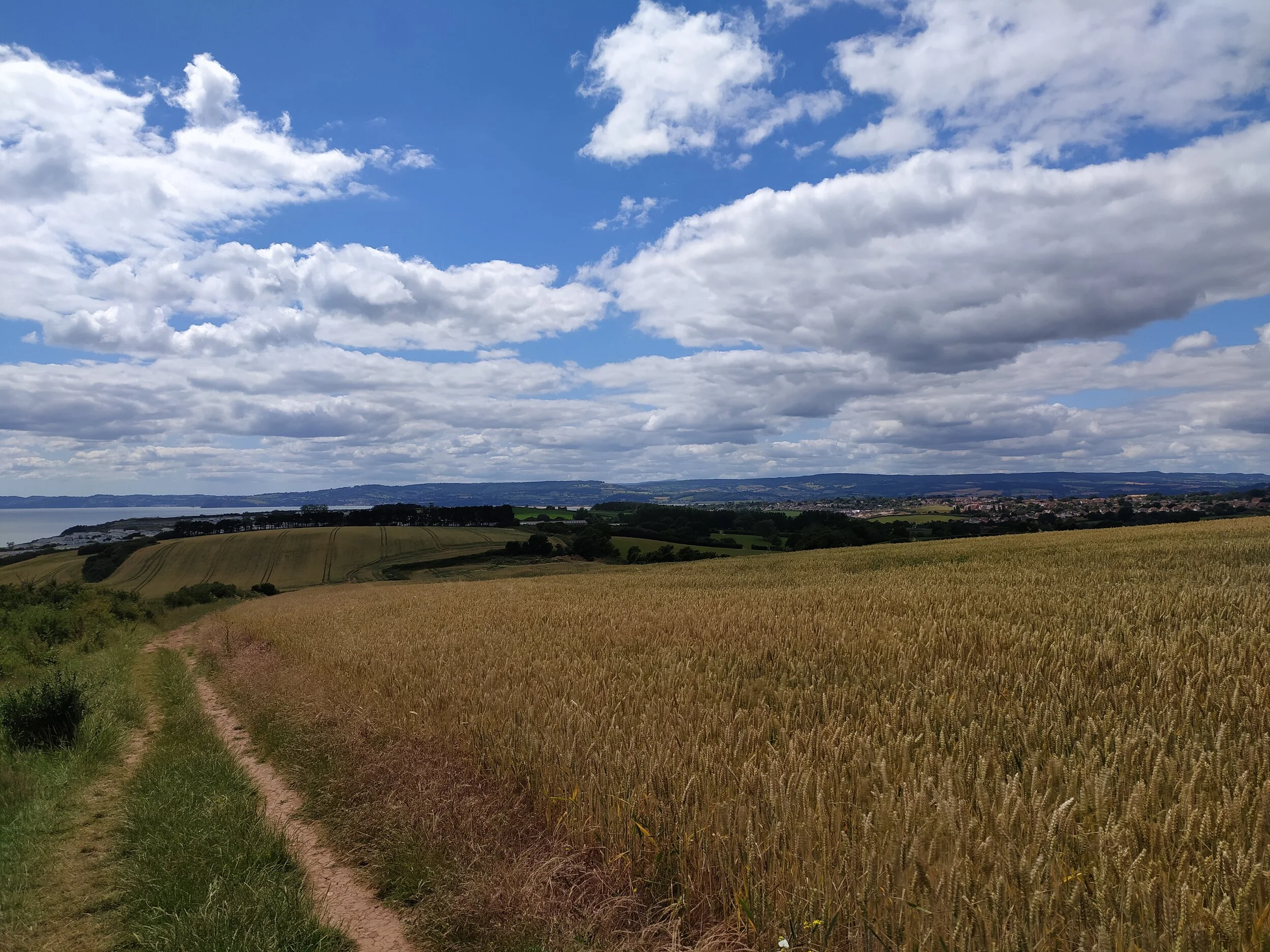
Views of East Devon countryside.

Views of the sea and rolling hills. Can you spot Bicton Obelisk to the left?
I keep to the left of this field and work my way up, today passing some cows grazing, and over a stile in the top left corner. From here I enter into Short Wood Common. I keep left on this path, ignoring a turning to my right, and again when I come to a little crossroads in the path I continue straight ahead. This area soon leads under tree coverage and into some woodland where I soon pass a rope swing on my left, tied to one of the many old rooted trees here. After a short walk through this woodland I arrive at the end of this path where I see a public footpath sign pointing towards where I’ve just walked. Here I turn right then turn left up a path where I spot a buzzard flying overhead.

Leaving the field and entering Shortwood Common.

Walking through the woodland
At the bottom of this dusty track I see a farm gate to my right, and then another one just round the corner to my left, which has views of Budleigh and the sea in the distance. Here I have a choice of two paths, I take the one on my right which takes me down a sheltered path past more large rooted trees. As this path comes out of the tree cover, I spot a house up ahead, this is Dalditch Farm. It’s not long before I walk past some houses on my right which have some rather interesting and quirky displays on their gates and outside their house, including a rather impressive metal robot. As I walk past this house I turn right up Dalditch Lane, passing a stream on my right. I soon come to a crossroads with a green space in the middle, here I turn right, up a stony path just left of Dalditch Farm.
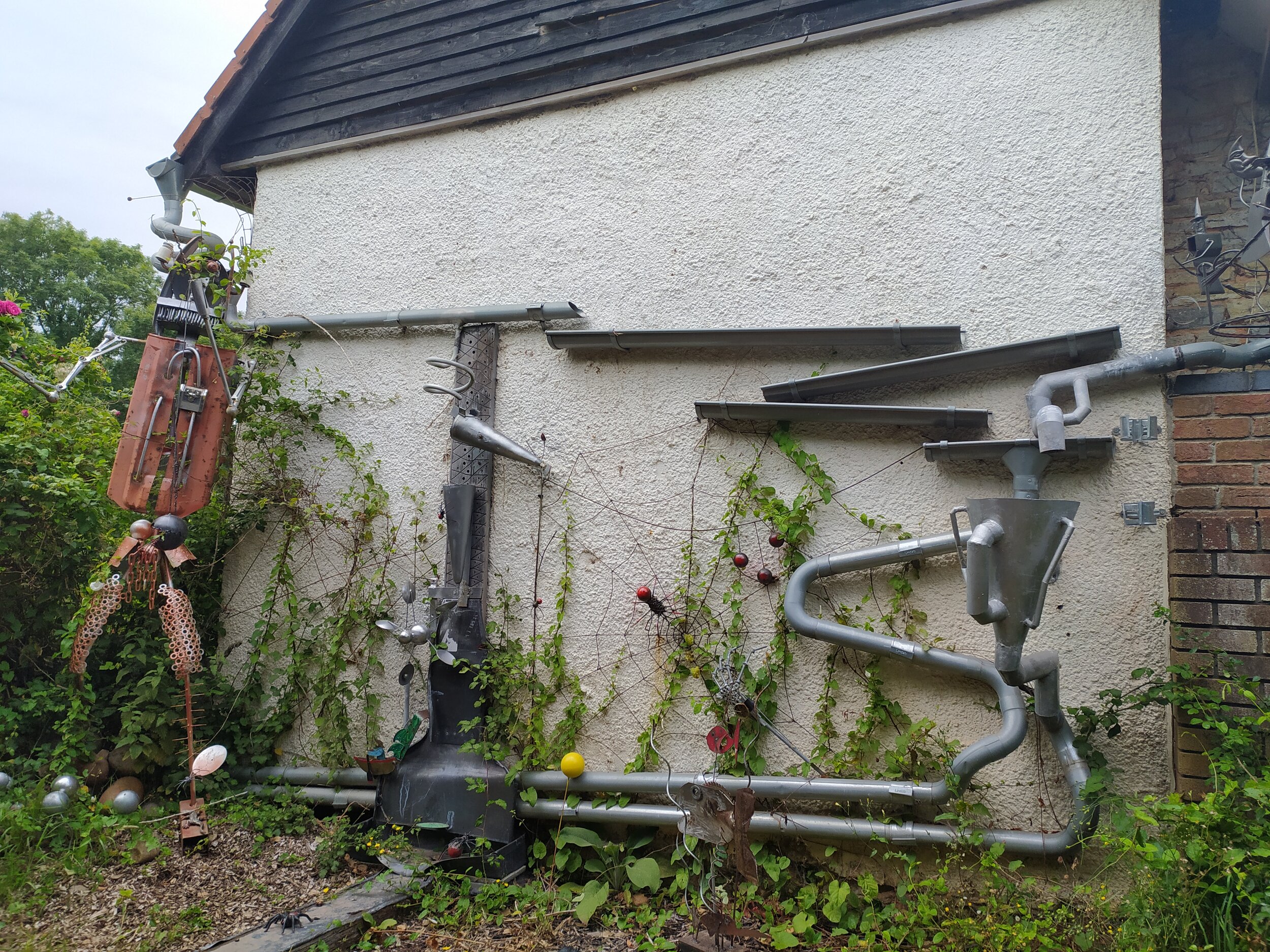
The impressive drainpipe display and metal robot.

A very interesting and quirky gate.
After a short walk up this path, I soon come to a wooded area where I take a path to my left, clearly signposted as a footpath, I continue along this path, being careful of the tree roots underfoot. This path is beautiful during the spring and summer months, bursting with colour from the pinks, purples and yellows of the heather and gorse, reminding me I've now arrived back into the pebblebed heaths. The path soon becomes sheltered again, where I soon spot some bees flying around some apiaries (man made beehives) to my left in a field. I continue on for a while, ignoring an option to turn right I carry on ahead where it eventually opens out into a meadow. Just at the top of this meadow is Squabmoor Reservoir so be aware if you have children or dogs with you, as this is very deep water, and also a busy fishing spot.

Taking the clearly marked footpath to the left towards Squabmoor.

The beautiful colours on the pebblebed heaths.
As I walk further up the meadow I now see Squabmoor Reservoir in front of me, here I cross the small car park and walk a path with the reservoir now on my left. This area is popular for fishing, but it’s also home to a lot of wildlife. Today I saw a family of ducks and a few swans enjoying the water amongst the lily pads. I continue walking along this path where soon I leave Squabmoor behind and enter onto a stony path. When I arrive at a fork in the path, I turn right and then at the end of this path, I turn left where it then opens up onto East Budleigh Common again. This path soon widens, where eventually at the top of the hill I turn right. I carry on along this path, ignoring the first turning on my left, until I arrive at a clearer path on my left. I walk up this track where soon I see the familiar remains of an old brick Nissen hut in front of me that I saw at the beginning of my walk. I now turn left up this track where I’m soon back at Wheat Hill car park where I started. This walk took me around 2 hours to do and wasn’t too strenuous. As I said before, its very dog and child friendly, but you do have to be careful walking on the road through Yettington. If you want to extend your walk slightly, you can visit Bystock Pools Nature Reserve which is just down the road from Wheat Hill Car Park and Squabmoor Reservoir. Here you’ll find a beautiful pond filled with lily pads and alive with all kinds of wildlife.

Walking along side Squabmoor Reservoir.

Squabmoor Reservoir.