Noss Mayo Coastal Loop

It felt so good to be back visiting the South Hams again, for anyone who’s never been to this beautiful area of South Devon, it’s so worth a visit! To me, when I think of the South Hams I think of lovely little fishing villages scattered about, the beautiful rugged coastline with the bluest sea, and of course Start Point lighthouse. Sadly we didn’t see my favourite lighthouse on this walk, but we did visit Noss Mayo, a quaint little fishing village that I’ve been meaning to visit for quite some time.

Views of Noss Mayo and boats on the River Yealm.

Views of Noss Mayo and boats on the River Yealm.

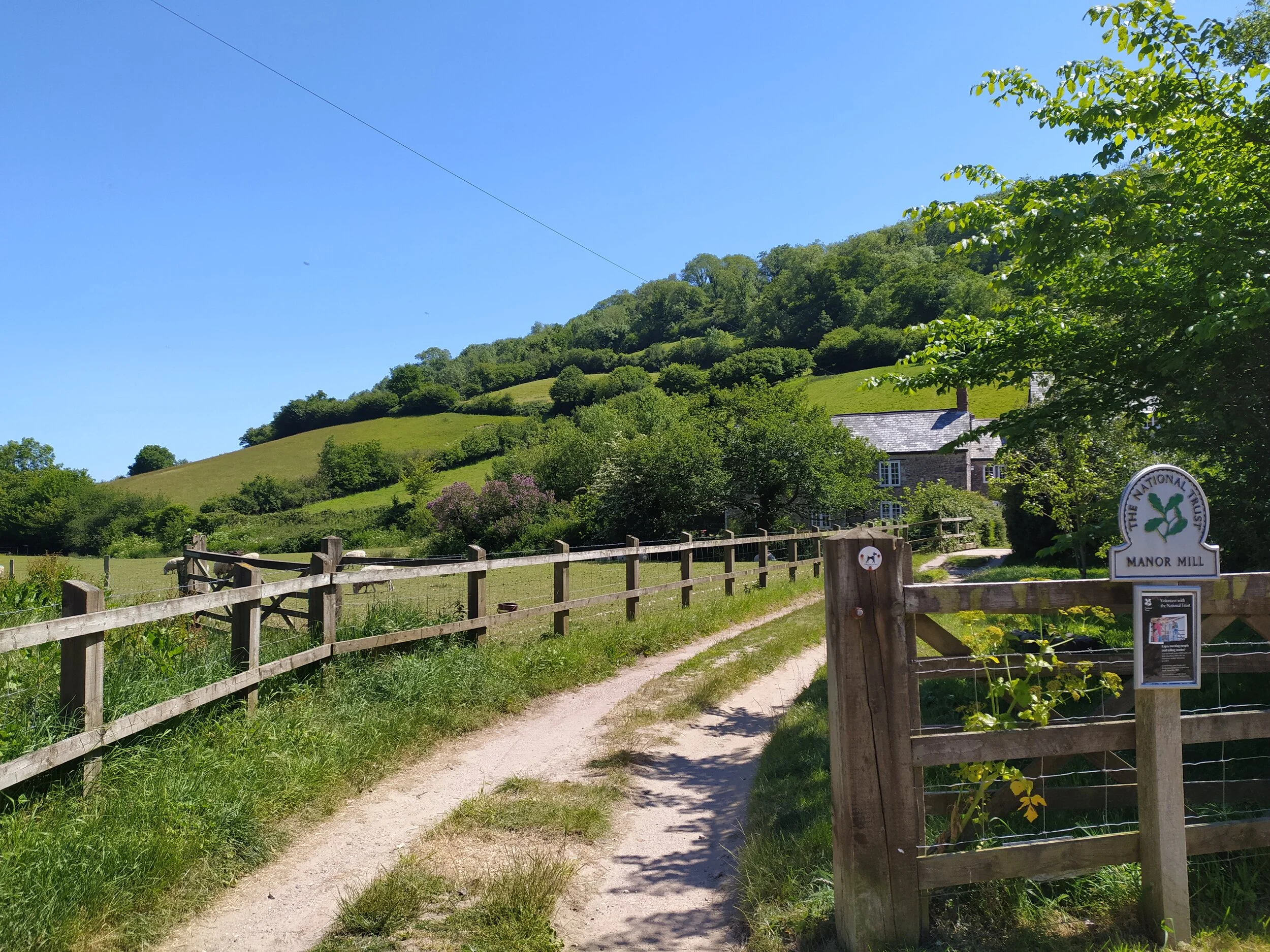
If anyone is interested in doing this walk it’s handy to know that parking is quite limited in Noss Mayo, as it really is quite a small village. There’s two free car parks in the village itself (Tidal and Tennis court car parks) but we found these to be quite busy so we parked in another free car park along the coast path which was owned by the National Trust. There’s two of these car parks that join the coast path, we parked in Warren car park but there’s also Stoke car park just up the road.

The gate to the coast path.

The gate to the coast path.

Once parked up, there’s a map in the corner of the car park, by the gate that leads down a path. After having a quick look at the map we followed the path down towards the sea in the distance. Once at the end of the path we reached a gate and stile, from here we joined the coast path and turned right, which a sign post informed us we were 3 miles from Noss Mayo.

The beautiful coastline of the South Hams.

The beautiful coastline of the South Hams.

As we followed the path round there were beautiful views over a stone wall to our left of the sea glistening from the sun over head. In the little coves the sea was turquoise in colour and so clear, it really does make you feel like you’re on holiday somewhere else! Once round the corner we saw a lovely little stone house on our right, from here there were two paths we could take. We decided to take the path to our left and through a gate, which then went down a slope and carried on through some smaller lesser trodden paths. In hindsight this was a mistake as we then had to walk back up the very steep cliff carrying a 9 month old baby, I’d recommend instead sticking to the main path at this point, going past Warren Cottage. The path we took was nice though and there was also another path which leads down some steps to a little cove called Searush Cove. We decided against going down there today, as the tide was coming in quite quickly, and as it was already nearly 2pm, we wanted to crack on and get to Noss Mayo.

Views of the cove below.

Views of the cove below.

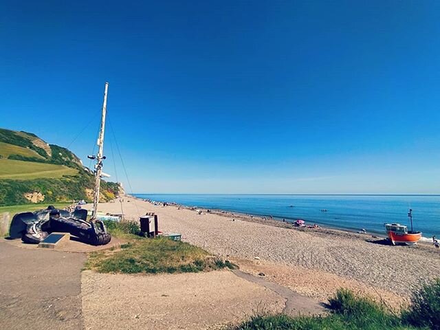
As we continued along the coast path, I spotted Great Mew Stone ahead, sorry to disappoint, but this island has nothing to do with pokemon. It’s actually an old english name for Herring gull, which are one of the many birds that now live here as it is now a wild nature reserve. This Island made me realise just how close we were to Wembury beach, which is another lovely place worth visiting, they have their own marine conservation centre there, but its also popular for surfing and rock pooling.

Great Mew stone in the distance.

Great Mew stone in the distance.

As we carried on the path and walked past another dry stone wall to our left, in the distance i spotted Wembury church and bay. We were then treated to stunning views of the mouth of the River Yealm, home to dozens of boats, with people on board enjoying the blue sky .

One sailing boat, you can just about see Wembury church and bay in the distance.

One sailing boat, you can just about see Wembury church and bay in the distance.

Boats in the mouth of the River Yealm.

Boats in the mouth of the River Yealm.

After watching the jet skis and yachts for a few minutes, we then descended down to a shaded path, draped with pretty pink camellias. As we walked along this path, the sweet smell of the flowers filled the air. Through the trees we still had a beautiful view of the boats on the river, as we walked closer inland, we could see paddle boarders and kayakers also enjoying the water.

The path draped with Camellias.

The path draped with Camellias.

The view through the trees.

The view through the trees.

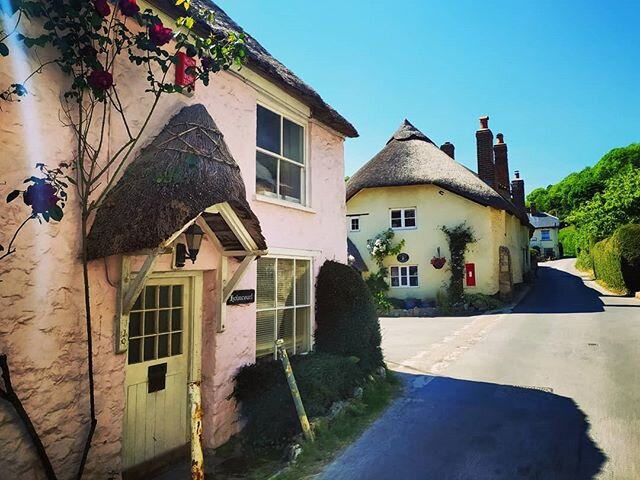
At the end of this sheltered path, we exited ‘The Warren’ to discover some beautiful cottages; As I was admiring them, I noticed one was a holiday home called ‘Coastguard Cottage’, I can only assume because this is where the coastguard used to be based. We then walked past more beautiful houses before reaching another sheltered path. A map here informed us we were about to take some steps down into Passage Wood which would eventually lead us to Noss Mayo.

Old Coastguard Cottages.

Old Coastguard Cottages.

The path through Passage Wood.

The path through Passage Wood.

Through the woods, we still had the vibrant blue of the river to our left, after a short walk along this path, we were greeted to the Ferryman’s Cottage on our left and a house on our right that had old ferry prices marked up on a sign. We had a quick read of the board before continuing on a country lane that eventually welcomed us into the fishing village of Noss Mayo.

Old Ferry prices on a wall.

Old Ferry prices on a wall.

Views of the River from the country lane.

Views of the River from the country lane.

Once we left this country lane, we arrived into the heart of the village, from here we walked past countless cute cottages and a bell topped village Hall before finding a spot by the river called Popes Quay for our picnic. We had great views here of people enjoying the water, paddling, kayaking and paddle boarding, As we finished our lunch, it had become more quiet, as the tide had slowly gone out, so we decided to walk back on the riverbed to continue our walk.

received_2724692367773434.jpeg
cute cottages
The bell topped Village Hall.

The bell topped Village Hall.

We walked to the right of the Village Hall and round some roads to the left, where we found the tennis court car park. Here was also the entrance to Brookings Down woods, which is where our loop continued. We entered the wood from the right and followed the main path all the way round, we then took the left path when we arrived at a fork. Eventually we heard a river flowing through the woods as we arrived at a gate that exited this woods onto a country road. From here we crossed the road and followed a public footpath sign onto another wooded path. It was a bit of a steep climb up to the top before it opened up onto a road.

The views from Popes Quay.

The views from Popes Quay.

Walking the path to the top of the woods.

Walking the path to the top of the woods.

From here we carried on up the road, ignoring any turnings to the right. Eventually we passed Rowden Court on our right, which looked like a beautiful Barn Conversion, complete with a tennis court! From here we carried on straight ahead, ignoring a public footpath to out left, we eventually reached a crossroads with sea views ahead. We crossed this road and continued on down where we were eventually met with a caravan park.

Rowden Court.

Rowden Court.

From Revelstoke Caravan park, we followed the main road that leads through it, ignoring signs for Stroke Beach (somewhere I think would be worth a visit another day) to the left, At the bottom of this road was a red phone box converted into a book library. We had a little look but it was a bit neglected of books and rather full of cobwebs. What interested me more was the rather impressive derelict church. Having a look around, we discovered it was the Church of ‘St Peter the Poor Fisherman’, and is 800 years old. It is in remarkably good structural condition, although it is lacking most of its roof. Information inside told us this church was abandoned when it fell into a state of disrepair and a new one was built in Noss Mayo instead, although they do still hold services here twice a year.

St Peter the Poor Fisherman Church ruins.

St Peter the Poor Fisherman Church ruins.

Derelict Church, lacking a roof.

Derelict Church, lacking a roof.

After exploring the church, we took the road that continued to the right. From here we followed the coast path arrows through the caravans, then a little wooded area and finally through a gate and onto the coast path again. From here we were greeted with stunning views to the left of Bolt Head in the distance. We now followed a path through some gorse, and an abundance of fox gloves. Little lambs bleeted as their mothers grazed on the land infront of us. As it was starting to get late in the day, I could hear some stonechat birds chirping away in the gorse.

Views of the coast in the distance.

Views of the coast in the distance.

The path through the gorse at dusk.

The path through the gorse at dusk.

From here we were a mile or two from where we started. As we carried on along this path we spotted an old stone house on the hill to our right. The path widened out into a double width track, originally built by Baron Revelstoke to show off the coast to his guests via horse drawn carriage. As we were then nearing the car park, I spotted the familiar view of Great Mew Stone in the distance. From here we soon reached the footpath we started on where we now turned right, through the gate and back towards the car park. It was a long but satisfying walk. We both definitely want to come back again, possibly taking our kayaks with us to explore Noss Mayo via the water.

Great Mew Stone spotted in the distance, and a old stone house on the hill.

Great Mew Stone spotted in the distance, and a old stone house on the hill.

coastline

Branscombe Circular Walk

With this beautiful weather we’ve been having lately, we thought we would take a trip to one of our favourite places in East Devon; the village of Branscombe. We’ve been quite a few times, but we wanted to explore the area more, instead of doing our usual walk along the beach then to the pub (which are all sadly closed at the moment!).

Views of Branscombe beach from the coast path.

Views of Branscombe beach from the coast path.

This circular walk we did starts off at the main car park in Branscombe, right by the beach. We first enjoyed a picnic on the beach in the sunshine, then started on our walk towards the village. From the beach, we followed a public footpath to the left of ‘The Sea Shanty Beach Cafe’. and followed a path along side a stream which flows from the village into the sea.

IMG_20200525_140739.jpg

I can imagine the stream is popular with dogs going in for a dip to cool down on a hot day like today, as there was quite a lot of worn down tracks leading to the water. It’s also handy to note on this walk there were a few picnic benches dotting around, so if you wanted a quiet place to sit and have a picnic away from the busy beach, this path, alive with meadow flowers and birds singing would be perfect.

We followed the path straight ahead, past the Manor Mill which is owned and run by the National Trust. Here there were sheep grazing in the field with their curious lambs watching us as we walked by. There were also doves cooing on a barn roof to the right. I stopped for a moment to watch the lambs playing before carrying on towards a kissing gate.

National Trust Manor Mill

National Trust Manor Mill

After we left the trail through the gate, we continued to follow the stream straight ahead and onto a road where we were greeted with the thatched roof of the National Trust Forge. Despite Branscombe being well known for its many quaint little cottages, the Forge definitely stands out amongst the others. Reading a little about the Forge on a notice board, it is known to be the oldest working forge in Devon, and was built around 1580.

Branscombe Forge, blacksmiths here make decorative ironworks to sell.

Branscombe Forge, blacksmiths here make decorative ironworks to sell.

As we turned left towards the hill, we admired some of the ironwork the blacksmiths had made at the Forge and had on display outside. You can just about make out in the picture above, the gate on display to the left, which had decorative bluebells on it.

Forge Cottage, available to let through the National Trust.

Forge Cottage, available to let through the National Trust.

As we continued up the hill, on the opposite side to the Forge is the Forge Cottage, a big yellow thatched cottage which I believe is a holiday let. It definitely stood out amongst all the other houses. As we walked up the hill I took one last look down the road, and couldn’t resist one last photo of the cottage and forge together before carrying on with our walk.

IMG_20200525_143815.jpg

With the sun bearing down on us, we decided to take a break once we got to the top of the hill, but first we admired some more beautiful cottages along the roadside, this is one of the roads out of Branscombe I always remember, the cottages are all decorated with beautiful flowers which really bring out the character of Branscombe.

One of the beautiful cottages in Branscombe.

One of the beautiful cottages in Branscombe.

Once we walked past these cottages, we found a bench by the village church, St Winifred’s. We sat here for a drink and took in the views down into the valley and admired some more cottages as we walked further along the road. As well as the cottages, a garden just up from the church really stands out as you walk past, its called ‘Doreen’s Garden’, I assume because its owned by a lady called Doreen! She lets people walk around this garden for free, but does ask for any donations to Devon Air ambulance. We didn’t walk around the garden today, but next time we visit I definitely want to, especially when our little girl will be old enough to enjoy the full colour of the flowers, ornaments and the doves cooing above in the dovecote.

Doreen’s Cottage, opposite her garden.

Doreen’s Cottage, opposite her garden.

Just a small section of Doreen’s impressive and intriguing  garden.

Just a small section of Doreen’s impressive and intriguing garden.

Once we walked past all these pretty cottages, we then approached a public footpath on the left. We didn’t follow this route, instead we carried on towards yet more cute cottages, and towards the Fountain Head Pub. Normally, it would be a perfect place to take a break and grab a bite to eat, but today it is of course, like every other pub, closed due to the pandemic currently happening, so we sadly had to walk past and remember it will soon be back to business and open again to enjoy.

Some more beautiful cottages Branscombe has to offer, and the Fountain Head in the background.

Some more beautiful cottages Branscombe has to offer, and the Fountain Head in the background.

The Fountain Head.

The Fountain Head.

We turned left at the pub, and once we had rejoined another road, we needed to find a footpath sign heading towards the coast. We first walked up the hill, as we couldn’t easily see the sign, but once we were up the hill, and failed to see it, we walked down again and realised it was in fact slightly down the road, hidden by a hedge. If you decide to do this walk, don’t make the same mistake as us!

The footpath we struggled to find.

The footpath we struggled to find.

This footpath takes you up towards a trail shaded by trees and surrounded by wild garlic, which welcomes you with a National Trust sign informing you it is called ‘Pit Coppice’. We followed this path for a while until it then leads you through another gate and into an open meadow. We followed this path all the way along until we reached a signpost pointing us to the left, back towards Branscombe.

The trail through Pit Coppice.

The trail through Pit Coppice.

Once turning left towards the coast path, you’ll follow another trail for a short while, it will boast beautiful views of Branscombe village to the left when it opens out into a field occupied by cows. Carry on walking the trail and eventually you’ll spot a lookout point to your right, which teases you with views of the blue sea and Branscombe pebble beach below.

The view of the sea and Branscombe beach from the coast path.

The view of the sea and Branscombe beach from the coast path.

We carried on this coast path until it opens out to beautiful views of Branscombe beach and the cliffs beyond. You can also see the green hills that are part of the coast path leading to Beer. We’ve done that walk before, and although quite strenuous it is worth doing for the views and feeling of accomplishment. Here there is a bench you can sit and take in the views before heading down towards the beach.

Beautiful views of Branscombe beach and the coast path to Beer.

Beautiful views of Branscombe beach and the coast path to Beer.

The walk was now quite easy going as we walked down some steps and through a gate into a field of grazing cows with their calves. From here we followed the path along side a beautiful house on the hill, and soon spotted the familiar beach huts and the pebble beach infront of us.

Beautiful houses on a hill overlooking the beach.

Beautiful houses on a hill overlooking the beach.

IMG_20200525_160325.jpg

From here we had one last look at the beach, I love the iconic fishing boat that’s always here, representing Branscombe beach well. As we walked back to the car we were reminded of the shipwreck that happened on the beach in 2007 with the anchor of MSC Napoli that now sits at the entrance to the pebble beach greeting everyone who walks by. For anyone who hasn’t visited Branscombe before, its definitely worth a visit, the drive into the village is narrow country roads, but the character this East Devon village has to offer is a must see.

Branscombe beach with the iconic anchor and fishing boat.

Branscombe beach with the iconic anchor and fishing boat.