Today we went for a short (just under 3.5 miles) walk around Upottery in East Devon. For those of you who aren’t familiar with this place, Upottery is an idyllic little village, nestled into the Otter Valley, just off of the A30 close to Honiton. Here we had a series of Geocaches to do, which would take us on a walk around the village, through country lanes and footpaths. As it’s a fairly quiet Village, we were able to park on the roadside, just along from the local pub the ‘Sidmouth Arms’ , close to a crossroads.

We parked just up the road from the Sidmouth Arms. This pub was looking very inviting.
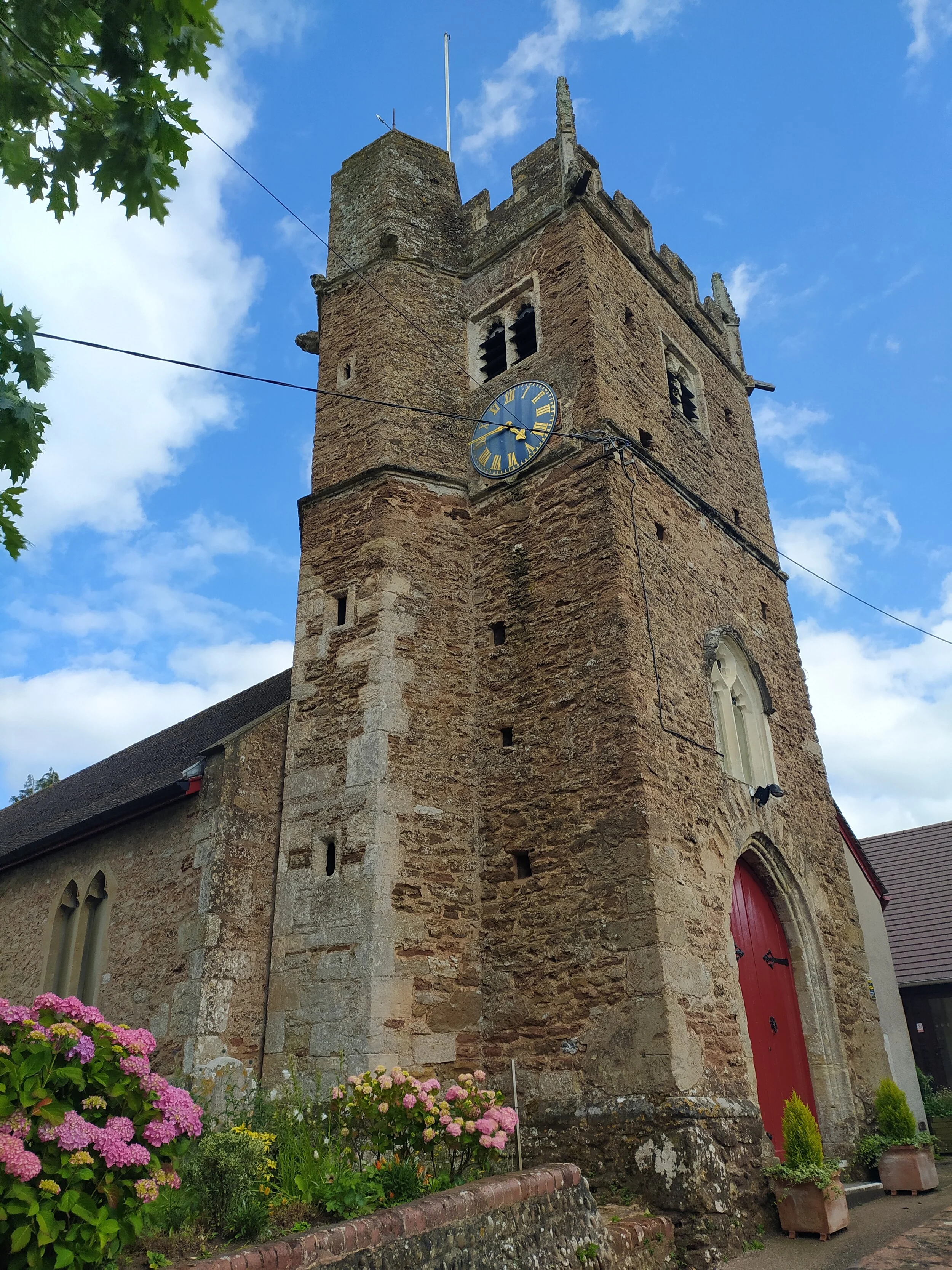
From here we walked down past the pub, and then took the first turning on the left, with St Mary’s Church on our right. Here we noticed an array of smilestones laid out around a War Memorial, I assume these were painted by the local children in the village. A lot of them were painted with rainbows and were thanking the NHS, obviously due to the pandemic we are currently dealing with.

Beautiful Thatch Cottages, with St Mary’s Church behind, and smilestones around the war memorial in the foreground.
After turning left on this road, we walked down past a cottage on our left, and were treated to beautiful views of the countryside ahead of us. From here we followed the road all the way around, past a house selling hand picked flowers for a small donation going towards their village hall. We soon came to our first geocache beside a footbridge over a stream. I won’t give anything away to anyone who wants to enjoy doing these caches, but some of the containers were rather interesting. For those of you unaware of what geocaching is, its a worldwide treasure hunt, a bit like letter boxing, but using GPS and a free app on your phone to log when you’ve found them. It’s pretty straightforward really, all you need is a pen and the app on your phone!

We came to our first geocache, by the bridge.

The River Otter passing under the bridge.
We took this road all the way up, soon turning left at the first turning we came to. Here was another geocache we found, before carrying on up this road, taking in the views of the village as we passed farm gates to our left. As we found another geocache by one of these farm gates, I spotted a buzzard circling above us and swooping down a few times towards the hedgerows. After watching the buzzard for a while, we then continued down this road, where we soon arrived at a footpath to our left. Walking along this path, we spotted plenty of wildlife, amongst them were red admiral and cabbage white butterflies, as well as being surprised by a couple of golden-ringed dragonflies that stood out from afar with their black and yellow markings. We were soon surprised to see a river flowing infront of us, which was of course the River Otter. At first we wondered how we would cross this river, until we got closer, then spotted the wooden foot bridge to the right.
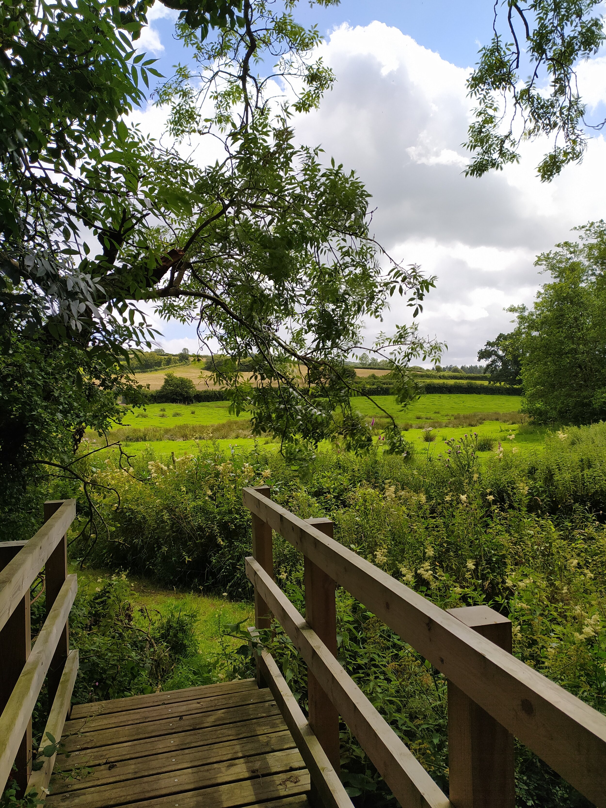
Countryside Views from the footbridge.

Looking at the River Otter flowing under the bridge.
We stopped on the bridge for a while, watching the river gushing past, before (eventually!) finding the next geocache which was situated in this area. From here we then walked up through the field, crossing a stile, then turning right up a leafy lane. Once we came to a junction on this lane, we kept to our left, where we soon found ourselves looking for another geocache in this series. Once found, we took a moment to take in the views of the rolling hills over the nearby gates before taking the path to our left.

The leafy lane we walked up, turning left at this junction.

Beautiful views over the farm gates.
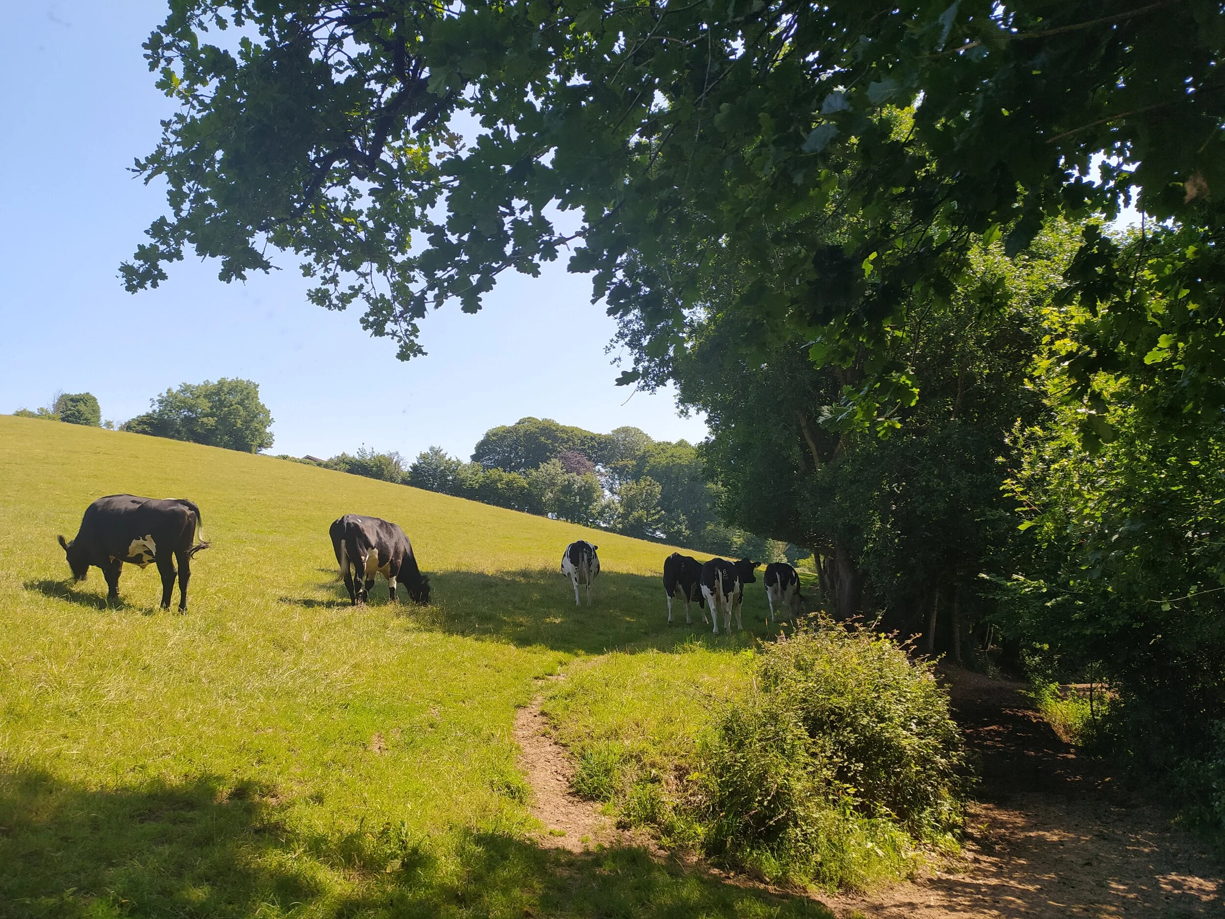
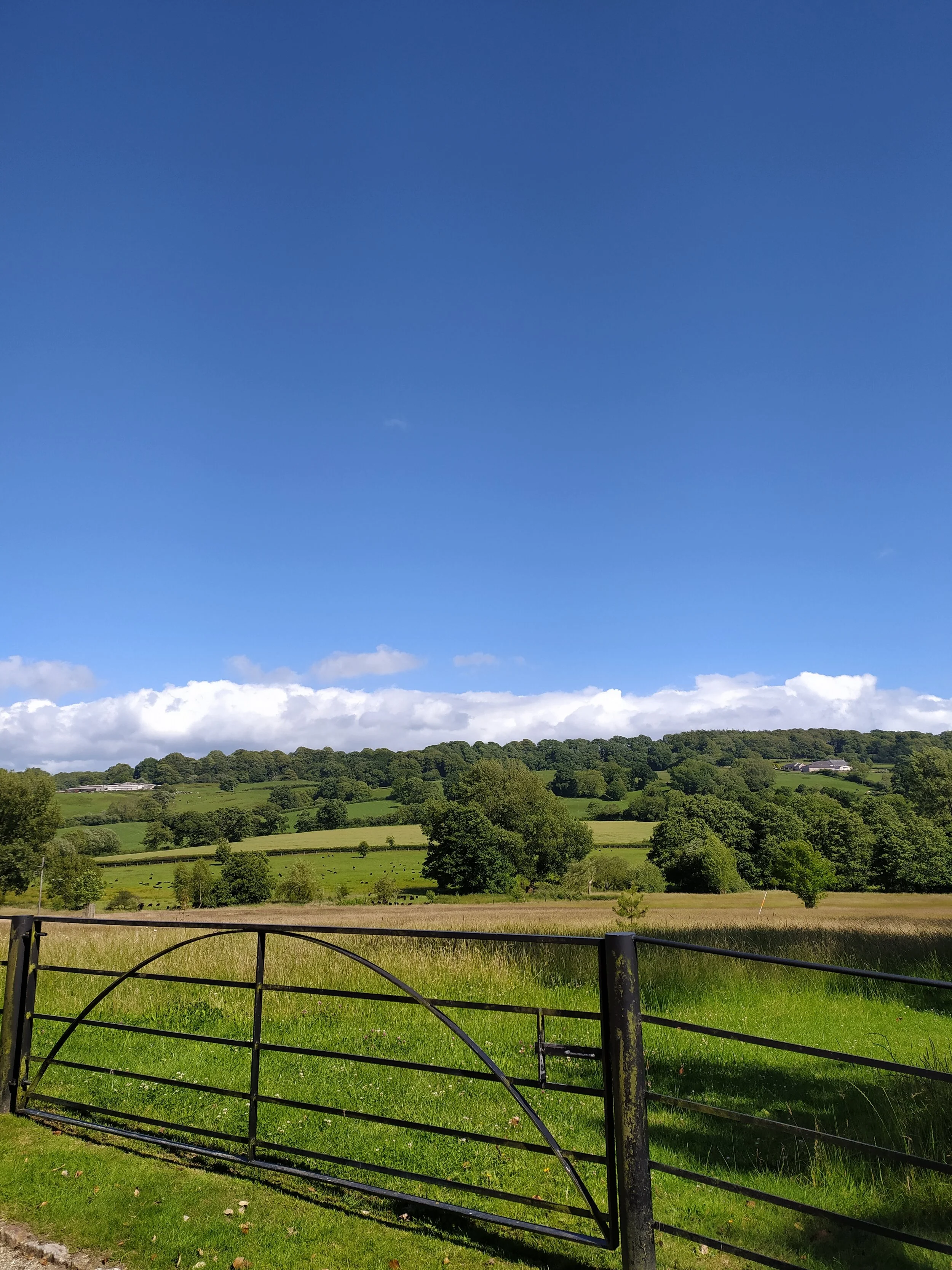
Along this next stretch of the path, we came across a large puddle of water, again wondering how we would cross it, until we noticed a raised path we could take to our left, with steps formed by the roots of the trees. Jo however decided to take the puddle route! We continued on from here, ignoring the path that goes off to the left, instead carrying on straight ahead up this lane. Along this path, we noticed some sheep and their lambs in a field, as we went to the gate to take a closer look, they came over to say hello, which was a nice surprise as they are usually very timid. From here we carried on up the hill and soon spotted a cottage roof peeping through the trees up ahead, showing us we were heading back in the direction of the village.

Making friends with the locals.
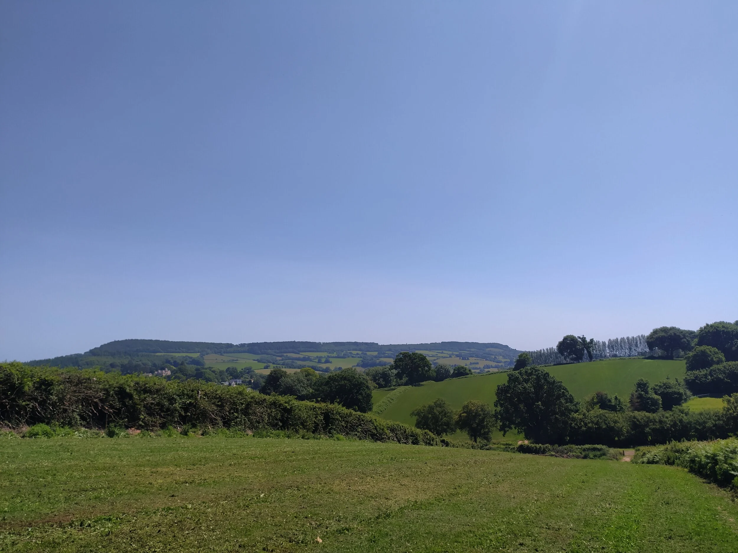
At the top of the hill came to a crossroads; Here we turned left down the main road which would take us back into Upottery, but first we stopped here to admire the fantastic views of the rolling hills and hedgerows which were now behind us. From this view point, we could also spot St Mary’s Church nestled into Upottery, which is just to the right of the photo below.

Rolling Hills and hedgerows.
After taking in the views, we walked down the hill, admiring some of the pretty buildings on either side of us. We soon passed a public footpath to our right, which looked interesting, but as we were following a geocache loop, we ignored the footpath, instead continuing on down the hill into the village. After plenty more gorgeous views of the local countryside, we were soon met with the entrance sign to Upottery, by now we had found 3 more geocaches, and it wasn’t long before we found the last one of this series as we walked past the old Victorian school house on our left. From this point, we soon arrived back to where we started in the Village. However, we decided to ‘clear the area’ of caches, by completing two more that aren’t part of this loop. We walked back past the pub, (somehow resisting the urge to go in for our first post-lockdown pint!) and entered the Church graveyard. After inspecting several headstones we discovered the coordinates for the next cache, and walked around the corner where the cache is found close to an old manor house, hidden behind the Church.

St Mary’s Church, where we found the coordinates for our next cache.

The Old Manor House, Upottery.
The countryside views by the Manor House.
Once we had found and signed our last geocache, we made our way back past the stone houses and the (still very welcoming!) pub to our car. We both agreed we would have to come back and try out the local pub and perhaps walk to explore the neighbouring village of Smeatharpe, which a nearby sign informed us was just 2.5 miles away. This walk was very leisurely, and although involved a few country lanes to walk down, they didn’t seem to get too busy, so would be fine for families and dogs. Be sure to try out the local geocaches as we were able to log all of them, with some being in interesting containers and most of them weren’t too hard!

The old stone houses and beer garden, Upottery.