River Otter walk to Bicton Obelisk and Church.

I discovered this walk a few years ago when out geocaching around East Budleigh, which led me to the old Bicton Church ruins. This made me explore the area a little more (on maps and looking at local footpaths), where I then found a circular walk from the River Otter to East Budleigh and Bicton. I sometimes make this walk a little bit longer, but the one I’m writing about today is just under 5 miles long. It’s important to add that this walk crosses the main road through East Budleigh (B3178) twice, so if you plan on doing this walk with dogs or young children, be aware when crossing this road. This walk starts out on White Bridge by the River Otter in Budleigh Salterton. There is plenty of free parking here, along South Farm Road.
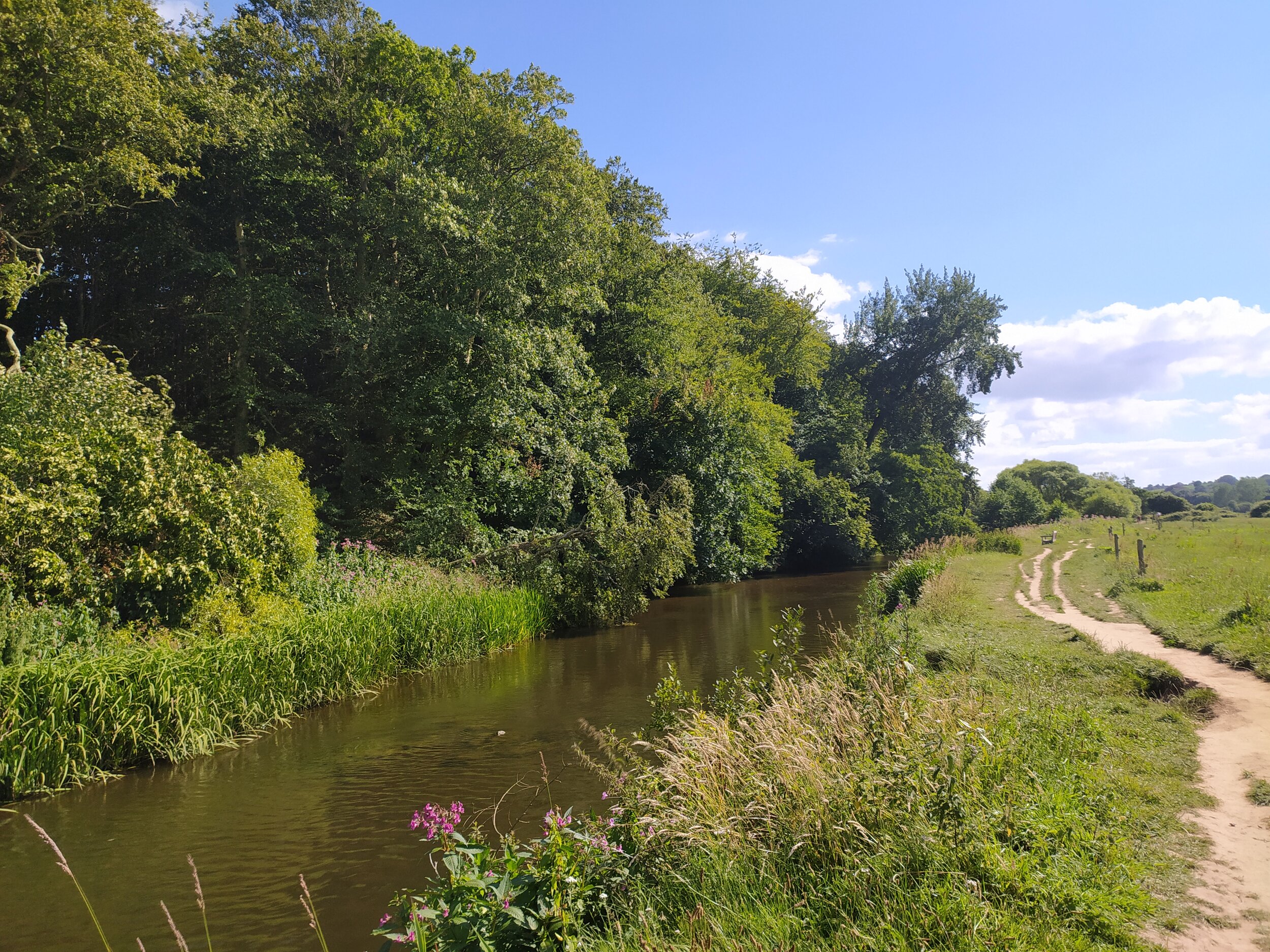
The River Otter.

The River Otter.

From here, I walked up towards White Bridge and turned left through the gate, joining the public footpath that informs me East Budleigh is 1 mile away. It’s not long before I spot a heron in the field to my left; this area is well known for the abundance of wildlife, so many species are thriving along the River and surrounding areas at the moment (including beavers which have been recently reintroduced!). After watching the heron for a while, I continued on the path, where eventually I pass a kissing gate. Here you can see the small Aqueduct which takes Budleigh Brook into the River Otter (preventing the fields from flooding), and today I could see water gushing into the river to my right. As I proceed there are two gates in front of me, I take the one to the left which now takes me on a raised path through the fields, which they sometimes have cows grazing in them, so take extra care with dogs..

The aqueduct that takes East Budleigh Brook to the River Otter.

The aqueduct that takes East Budleigh Brook to the River Otter.

This path is a lot quieter than the main riverside walk. I only saw two other people on this route today, perfect for a socially distanced walk! I follow this path as it bends to the left and briefly turns into a concrete walkway where it now takes me away from the river and closer towards East Budleigh. Soon I pass through a kissing gate and over a couple of footbridges, where the path then narrows and becomes partially shaded by trees. I then spot some houses to my right, which I’ll soon be walking past.

The houses to my right, which I’ll soon be passing.

The houses to my right, which I’ll soon be passing.

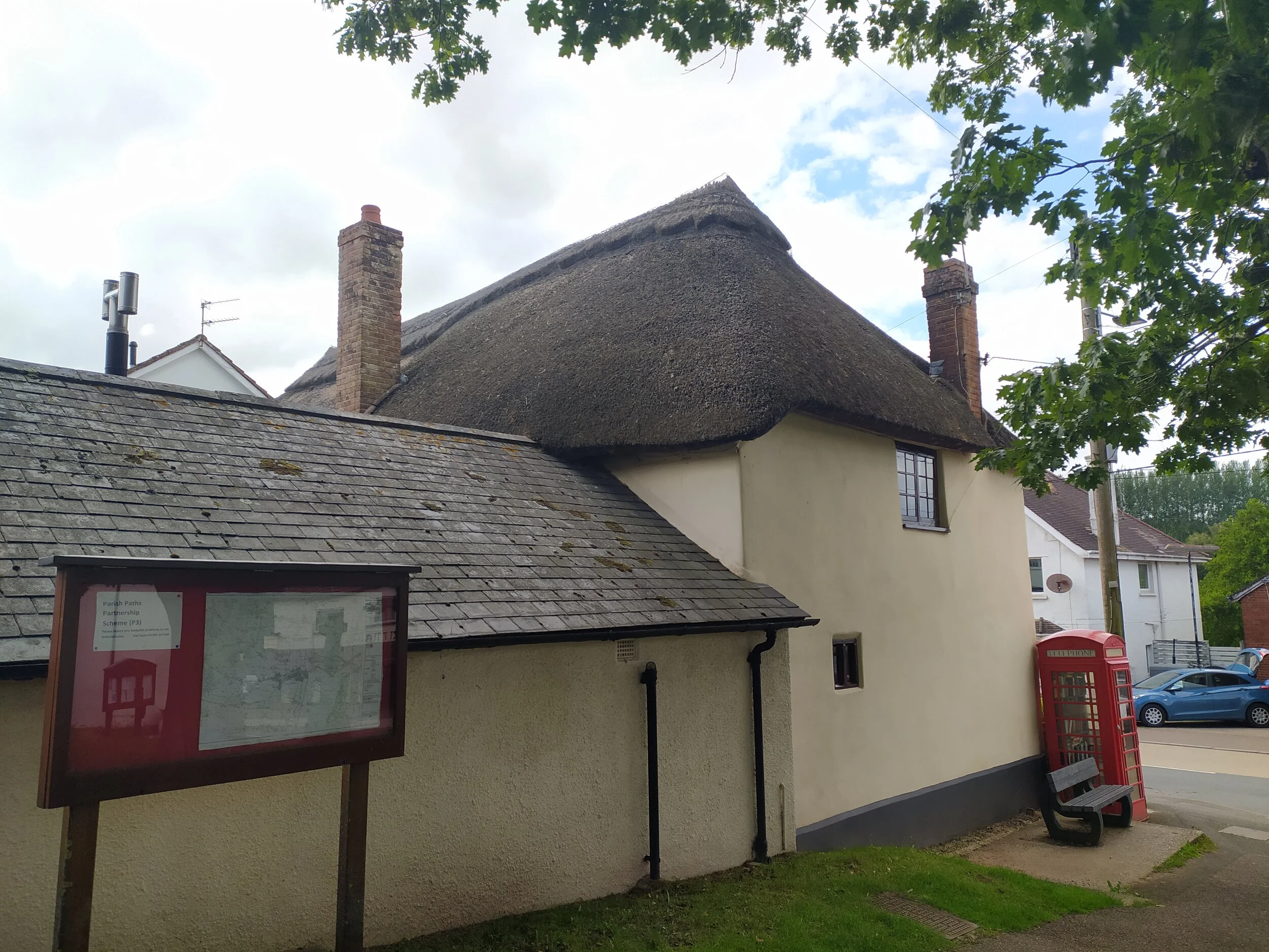
I carry on through two gates, continuing straight ahead, and then follow the path with the South West water plant on my right. This path soon joins a road where I turn right and pass the yellow house I spotted earlier (in the photo above) on my left. On a clear day like today, I can see beautiful views of Mutters Moor and Peak Hill over the farm gates to my right. From here I pass the yellow thatched cottage (Rose Cottage) I also spotted earlier on the walk. After passing this cottage, there’s a public footpath on the left, slightly hidden by the overgrown ferns, so keep an eye out for it! I climb over this stile, being careful of the stinging nettles growing nearby. The thatched cottage is now on my left, with a meadow in the foreground, as I walk through two metal gates and up a hill.

A house upon a hill.

A house upon a hill.

Views of Otterton Church and High Peak in the distance.

Views of Otterton Church and High Peak in the distance.

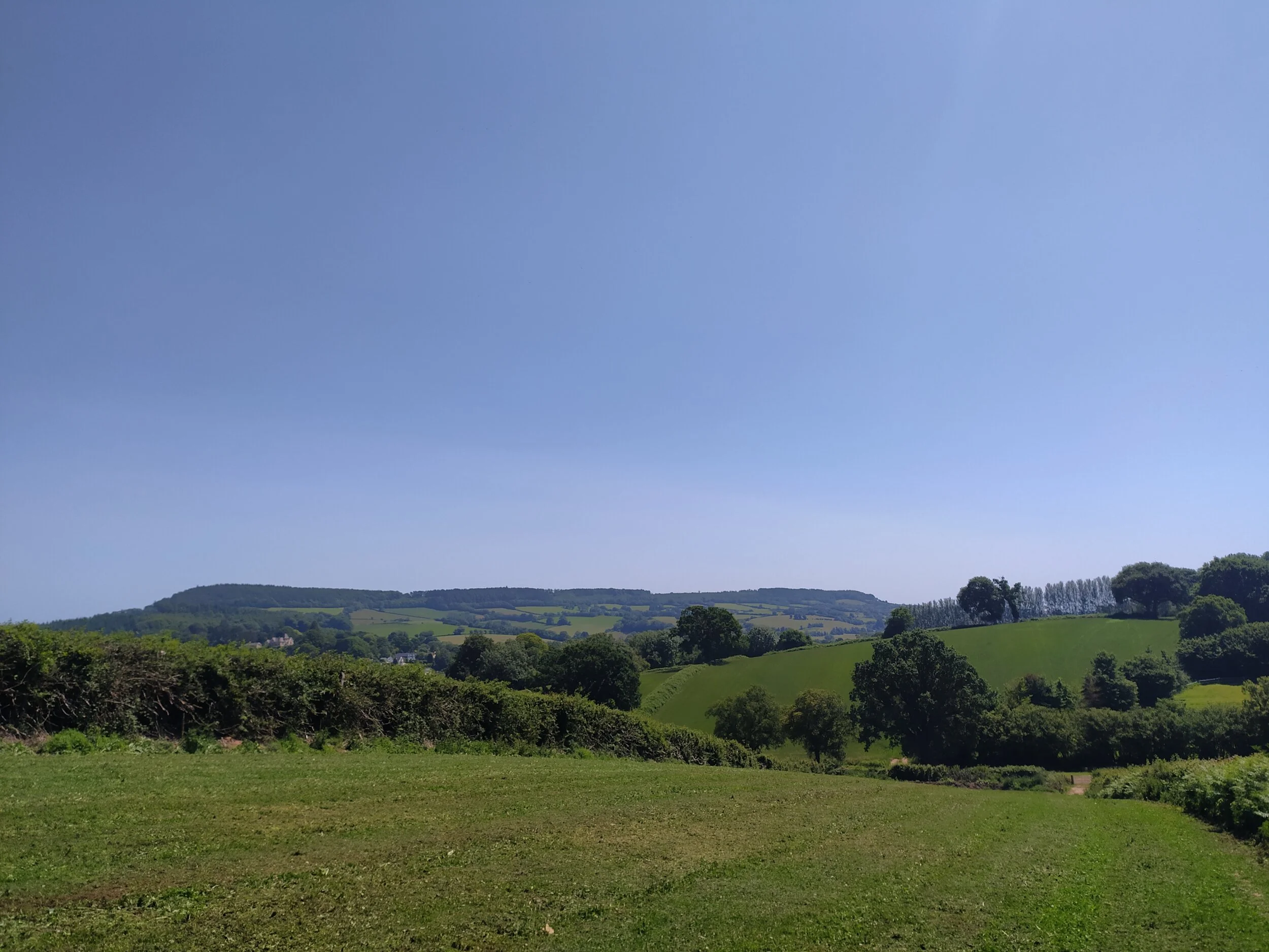
Soon I meet another metal gate, where I now enter a field and follow the (slightly overgrown!) path all the way round to the top, where today I spotted several butterflies landing on the path in front of me. It wasn’t long before I could hear the traffic on the main road that we’ll soon cross, but first I looked back and enjoy the views from the top of this field. Here I can clearly see Mutters Moor, Otterton Village and Church, Peak Hill and High Peak. I can even clearly see the path leading up to High Peak! Once I reach the stile at the top of this field, we have to cross the main East Devon road, so anyone doing this walk with children or dogs, make sure they’re safe and under control before climbing over the stile and crossing this road. Ignoring the metal gate straight ahead, I go through the wooden one clearly marked with a public footpath sign, just to the right. From this path I walk straight ahead through the field, spotting the Bicton Obelisk to my right, before passing through two wooden gates under a slightly sheltered path, which then leads out onto Middletown Lane in East Budleigh. I turn right down this lane, then cross the road and enter East Budleigh’s recreation ground. From here I make my way past the wooden hut and tennis courts in the far corner, and enter the woodland through a clear path ahead. If you are interested in exploring the village, you can take a slight detour by turning left (instead of right) down Middletown Lane, following the road all the way round, then turn right again where you’ll soon walk up past the local village stores, pub, church and Sir Walter Raleigh statue. From here keep walking round and eventually you’ll see a public footpath on your left leading you into the recreation ground where you can continue the rest of this walk.

East Budleigh Village.

East Budleigh Village.

The clear path through East Budleigh’s wild wood.

The clear path through East Budleigh’s wild wood.

This is East Budleigh’s Wild Wood, there are a couple of information signs in this woodland, which show a lot of the wildlife and different species of trees that are found here. There are more great views on offer here of the East Devon Countryside to the right. I then pass through the metal gate in the far right corner, and enter a field, where I follow the path towards a kissing gate, here I spot the Obelisk just ahead of me.

bictonobelisk
Farmland and countryside views to my right before leaving the field through a kissing gate.

Farmland and countryside views to my right before leaving the field through a kissing gate.

As I leave this field I am now on a country road which can sometime get fairly busy. From here I walk on the grass verge on the other side of the road and turn left when I find a stile to pass over into another field. Here I walk alongside the field that is home to Bicton Obelisk. As i follow the path around and through a metal gate at the bottom, I keep the Obelisk to my right the whole time. This path is slightly overgrown with stinging nettles and weeds, although a bit of an inconvenience to me, the local wildlife seem to be thriving along this stretch of the footpath, with plenty of butterflies, damselflies and swifts dipping into the fields to my right.

Views of Bicton Obelisk from the slightly overgrown footpath.

Views of Bicton Obelisk from the slightly overgrown footpath.

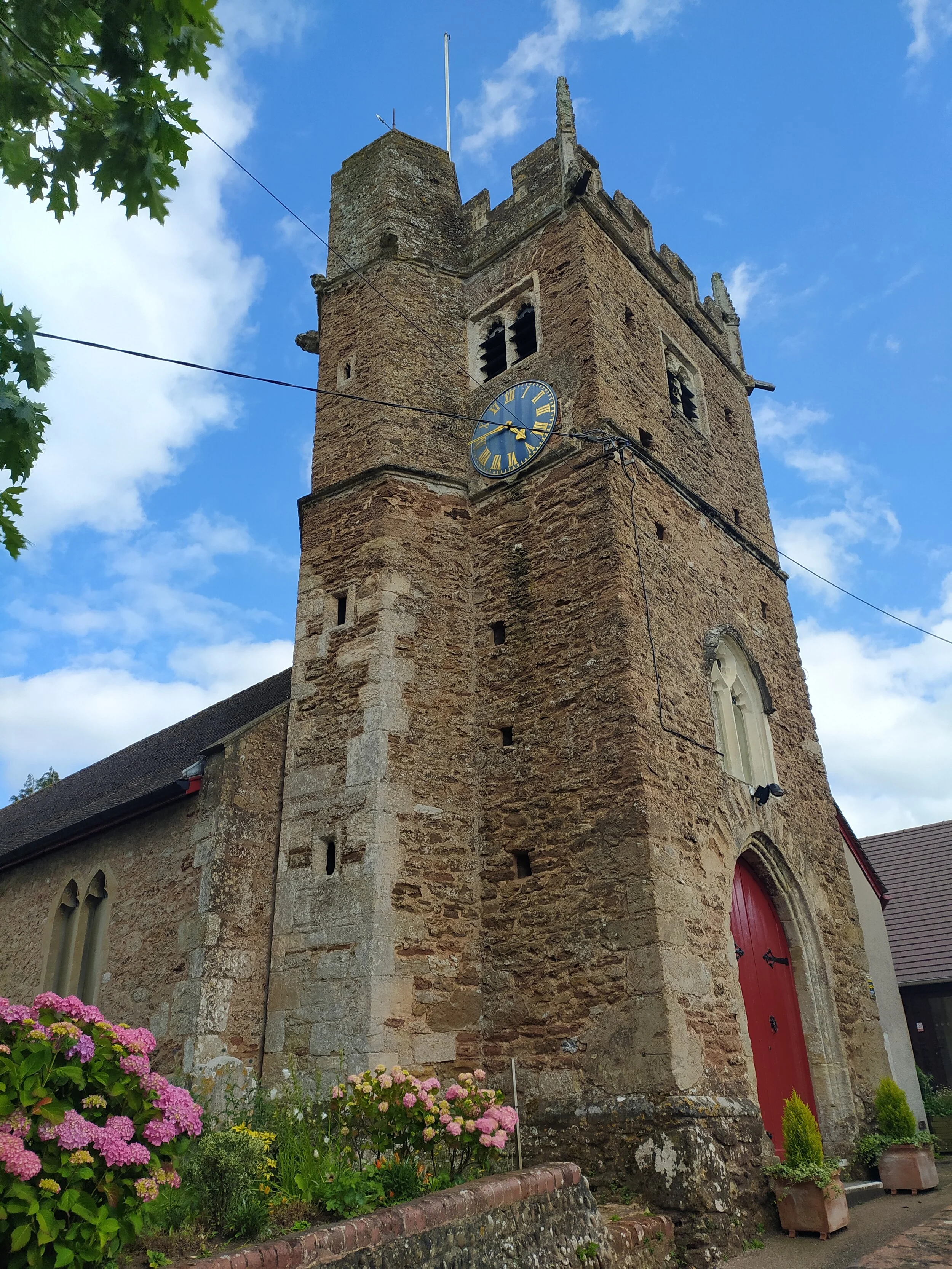
Soon this path opens up where I then pass an old barn to the left. Now I leave the views of the Obelisk behind as I enter into a little woodland path ahead. This path soon leads towards Bicton Church ruins, and I can hear the busy traffic on the main road ahead. From here I turn left walking between two high walls, where it leads me to a little car park with the Old Church ruins of a medieval gothic church in front of me (within Bicton grounds). I soon spot St Mary’s Church to the right of the ruins too, which was built to replace the older church. Both are impressive buildings to look at, although with the high walls and the lack of sunlight due to the shading trees, this area can become quite eerie after a while. From here I walk along a path between two walls again (to the right of the lych gate) which leads to the main road, so please again be careful if you have dogs or children, as cars drive fairly fast along this road.

churchpath
The ruins of Bicton Church.

The ruins of Bicton Church.

I carefully cross this main road, and then slightly down the road to the left I join a public footpath. Here I ignore the footbridge to the left, instead I follow the path straight ahead, where soon I spot the stream flowing on my left hand side. I’ll be following this stream all the way until it meets with the River Otter. I continue on this path, where I eventually pass through two metal gates and spot the familiar views of Otterton Church to my left. Soon I cross over the stream (via two stepping stones) and now walk with it flowing on my right hand side. I then come to a kissing gate with a sign informing me about the Beavers now living in this stretch of the River.

Pass through the kissing gate to the left.

Pass through the kissing gate to the left.

After passing through this gate, I soon cross over a footbridge where I can now hear the cars passing by on the main road into Otterton. When I come to a choice of two paths, I take the one to my left, as this path will bring me out closer to the footpath on the other side of the road. It’s not long before I spot the famous Otterton bridge (five bridges), where I leave this footpath through the gate, cross the road and join the next stretch of the footpath with the river and Otterton Mill on my left, which is a lovely place for a coffee break (they also do a great cream tea).

The footbridge over the river.

The footbridge over the river.

Once on this path, it’s fairly straight forward to get back to where I began my walk, I just have to follow the path straight ahead, where eventually it will bring me back to White Bridge. If you wish to do a bit more of a circular walk, you can cross the metal bridge (Clamour Bridge) half way along this part of the footpath on your left, from here you walk up the steps, turn right and follow the path all the way down, which leads you to the top end of White Bridge. This walk is fairly shaded and tends to be quieter than the main riverside walk, although there is no access to the river from this path. I love walking along the main path with the river to my left, as there’s plenty of access to the water where it’s nice to sit on the river bank here and watch the wildlife. Just walking along this path today, I spotted plenty of fish in the water, a kingfisher and wagtail flying across the river, as well as some ducks and swans with their young on the water. There’s also a few benches along the path to sit on which have nice views of the river below.

There’s plenty of access to the river.

There’s plenty of access to the river.

The path back to White Bridge.

The path back to White Bridge.

Despite this walk crossing the main road twice, it is still fairly dog and child friendly, with plenty of open spaces where both can safely run around. There’s also nearby pubs in East Budleigh (Sir Walter Raleigh) and Otterton (The King’s Arms) as well as Otterton Mill cafe right by the river on your way back. This walk took me just under 2 hours, and I was walking at a leisurely pace. It’s not at all strenuous but be aware there were some overgrown footpaths in places where stinging nettles were growing.

A great spot to take a break.

A great spot to take a break.

Newton Pop to Tipton St John circular walk.

I love walking the public footpaths of Newton Poppleford, either to Aylesbeare common, along the river to Otterton or towards Harpford and Tipton, there’s so many different routes to take through this lovely little village. I had a lot of interest in the walks I do from Newton Pop to Tipton St John, so I’ve decided to write down this 5 mile circular walk that takes you through public footpaths, woodland, along country lanes and then back along the river.

The River Otter, Tipton St john.

The River Otter, Tipton St john.

There’s plenty of places to park in Newton Poppleford. I prefer to park in School Lane car park, its a free car park opposite the Primary School, just turn right after the traffic lights (if coming from Exmouth/Exeter) on the main road and the car park is on the right. Alternatively, you can park along back lane (by the recreation ground). From School Lane car park, there’s a public footpath in the corner, by the garages, that leads down past St Luke’s Church on the right. I walk down this path and usually have a look at the red telephone box book library on the left, before turning right down the road, past some lovely thatched cottages.

Pass St Luke’s Church on your right.

Pass St Luke’s Church on your right.

A map of Newton Poppleford and the telephone box book library.

A map of Newton Poppleford and the telephone box book library.

After a short walk down the road, I soon pass a carpet and interiors shop on my right. From here I carefully cross the road and turn left onto Back Lane, walking past tennis courts and a play park on my left. Soon I spot a public footpath leading to fields to my right, I ignore this path (I’ll be coming back that way though) and instead turn left where I soon spot the garden plants for sale outside someone’s house. This is one thing I love about Newton Pop. It has such a community feel to it, you’ll find a lot of houses selling their local produce if you walk around and explore the village. Just before this house with the plants for sale is a gravelled path with the Orchard ahead of me and a metal kissing gate to the right;. I take this path through the kissing gate and into some woodland. From here, I follow the path ahead, being careful not to trip over tree roots underfoot.

The Orchards to the left, the footpath to the right.

The Orchards to the left, the footpath to the right.

The woodland walk, part of the East Devon Way.

The woodland walk, part of the East Devon Way.

Soon I come to a choice of two paths, one going up some steps to my left, and the other going down and over a bridge towards a field to my right. I turn left here and climb the steps, eventually I see some steps to my left, this footpath leads to the Orchard. Although a nice walk; I’m not going this way today, instead I carry on ahead, where eventually I walk up more steps and through a wooden gate leading to a field.

The steps leading to the Orchard.

The steps leading to the Orchard.

The footpath leads into a field.

The footpath leads into a field.

There’s a clear path on the outskirts of the field that I follow all the way down, through a kissing gate and where I can hear, and then see, the stream trickling underneath. This path turns left, where I then notice some interesting old trees, with roots wrapped around one of them. (If you do this walk, you’ll know the one I mean!) I soon leave this path and follow the footpath arrows pointing me up a hill. Once at the top of this hill, I take a quick break to take in the views below. From here I spot Fire Beacon Hill, Mutter’s Moor, Peak Hill and the trees in the Orchard.

The clear path through the fields.

The clear path through the fields.

Great views from the top of the hill.

Great views from the top of the hill.

After following the footpath through two more kissing gates, it soon leads onto Lynch Head road. From here I turn right and walk up the road which soon descends into the small village of Venn Ottery. Before I arrive in this village, there’s another great view point at the top of the road, over a farm gate. I stop for a moment and take in the views, spotting Tipton St John to the left, nestled into the Valley.

Tipton St John nestled to the left of the Valley.

Tipton St John nestled to the left of the Valley.

Once in Venn Ottery, I follow the road around to the right, where I also see a sign telling me this the way to Tipton St John. I’m soon treated to yet more beautiful views of the East Devon Countryside over a poppy field to my right as I edge closer towards the village. Once I arrive at the top of this road, I walk down the road to my right which leads into Tipton St John by the local Primary School.

Yet more beautiful views, over a poppy field.

Yet more beautiful views, over a poppy field.

Once in Tipton St John, I always admire the beautiful thatched cottage to my left, by the Primary School. The elegant windows really do stand out due to their interesting shape. If you’re doing this walk and want to cut it short, you can turn right at this junction, past the school and find the footpath before the bridge, which will take you back to Newton Poppleford via the river. Today I chose to walk further up the river towards Ottery St Mary. I turn left at the school junction and pass the Church of St John the Evangelist on my left, continuing up the road (Tipton Vale) with a stream to my right, until I spot a public footpath on the right.

Church of St John the Evangelist.

Church of St John the Evangelist.

I follow this footpath straight ahead, with fields on either side of me. Soon I cross over a stream via a little footbridge, then pass through a gate where I’m greeted by the River Otter with the old railway bridge (now a footbridge) just ahead of me. From here I carry on walking alongside the river, here is a great spot for dogs and children to play in the river, just by the bridge.

The River Otter.

The River Otter.

The Old Railway Bridge over the River Otter.

The Old Railway Bridge over the River Otter.

Once I pass under the old railway bridge, I carry on walking ahead until I meet a footbridge crossing right over the river. I decided not to carry on ahead towards Ottery St Mary today, instead I cross this bridge, passing Tipton Mill on my left, and turn right along a footpath into some fields. Here the river soon turns into a stream on my right as I enter some woodland and cross a couple of stiles, then walk alongside a beautiful garden that has the stream passing through it. From here I soon leave the footpath and enter into Tipton St John again.

Tipton Mill to the left.

Tipton Mill to the left.

Tipton Mill, currently under restoration.

Tipton Mill, currently under restoration.

Be aware, if walking with a dog, there may be livestock in these fields.

Be aware, if walking with a dog, there may be livestock in these fields.

Tipton is a lovely little village, as I turn right, towards the river, I pass another telephone box library on my left, a community stores on the right and then the local pub, ‘The Golden Lion’ with a beer garden that looks very welcoming in the sunshine. After walking past the pub, I cross over the river via a bridge that is decorated with beautiful flower boxes.

Tipton’s local pub, ‘The Golden Lion’.

Tipton’s local pub, ‘The Golden Lion’.

The rather welcoming pub beer garden.

The rather welcoming pub beer garden.

Beautiful flowers on the bridge overlooking the River Otter.

Beautiful flowers on the bridge overlooking the River Otter.

From here, I join the riverside walk via a footpath to my left. Again, this stretch of the River Otter has plenty of places for dogs to dip in and out of the water for a paddle. There’s some lovely views of the rolling hills to my right, and plenty of butterflies and dragonflies darting about between the river and the wild flowers. I follow the path along the river, passing through several gates.

There’s plenty of places for dogs and children to paddle in the river.

There’s plenty of places for dogs and children to paddle in the river.

Eventually, this footpath opens up, normally with cows grazing in a field to the right. From here, I soon spot the familiar sights of Newton Pop ahead, as well as Harpford Parish Church over the river to my left. I ignore the red bridge to my left which leads to Harpford, this is a lovely walk too, which I’ll hopefully document another day. The footpath to my right also leads back to the woodland that I started the walk in, by the gate to the Orchard. I continue on ahead, where I soon leave the fields through a gate onto Back Lane once again. From here, I walk down towards the tennis courts, then turn right onto a footpath, keeping the tennis courts to my right and a stream flowing to my left. I follow this path all the way along, until I reach a road to my left (Meadow Drive). From here, I walk up the road, and soon spot the familiar red telephone box on the other side of the road. Here I carefully cross the road (there is a pedestrian crossing to the left) and follow the path up beside the church, to end the walk back in the School Lane car park.

Harpford Parish Church on the other side of the River Otter.

Harpford Parish Church on the other side of the River Otter.

The walk back towards the car park.

The walk back towards the car park.

Hopefully this walk is clear enough for those of you who have asked me to document it. It’s an enjoyable walk to do, especially on a warm, sunny day, when you can sit and relax by the river, watching dogs and children playing and cooling down in the water. If you’re feeling more adventurous, you can make this walk even longer by walking further up towards Ottery St Mary. For those of you interested, I’ll post more about that walk another day.